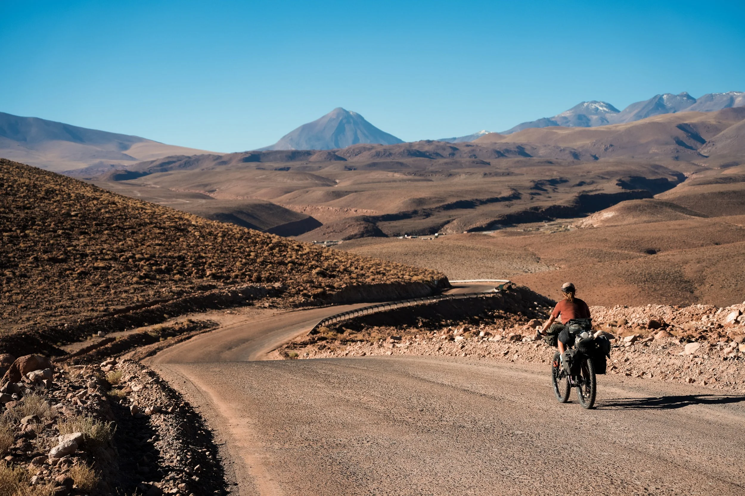
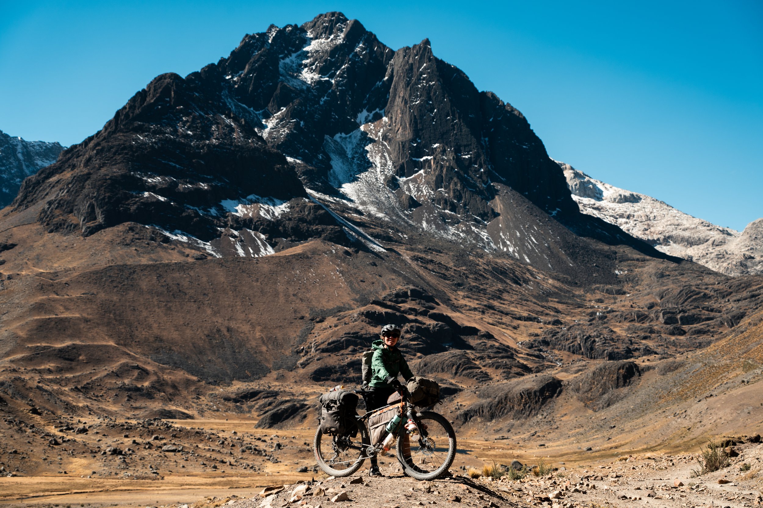
Oruro to La Paz via Mama Coca

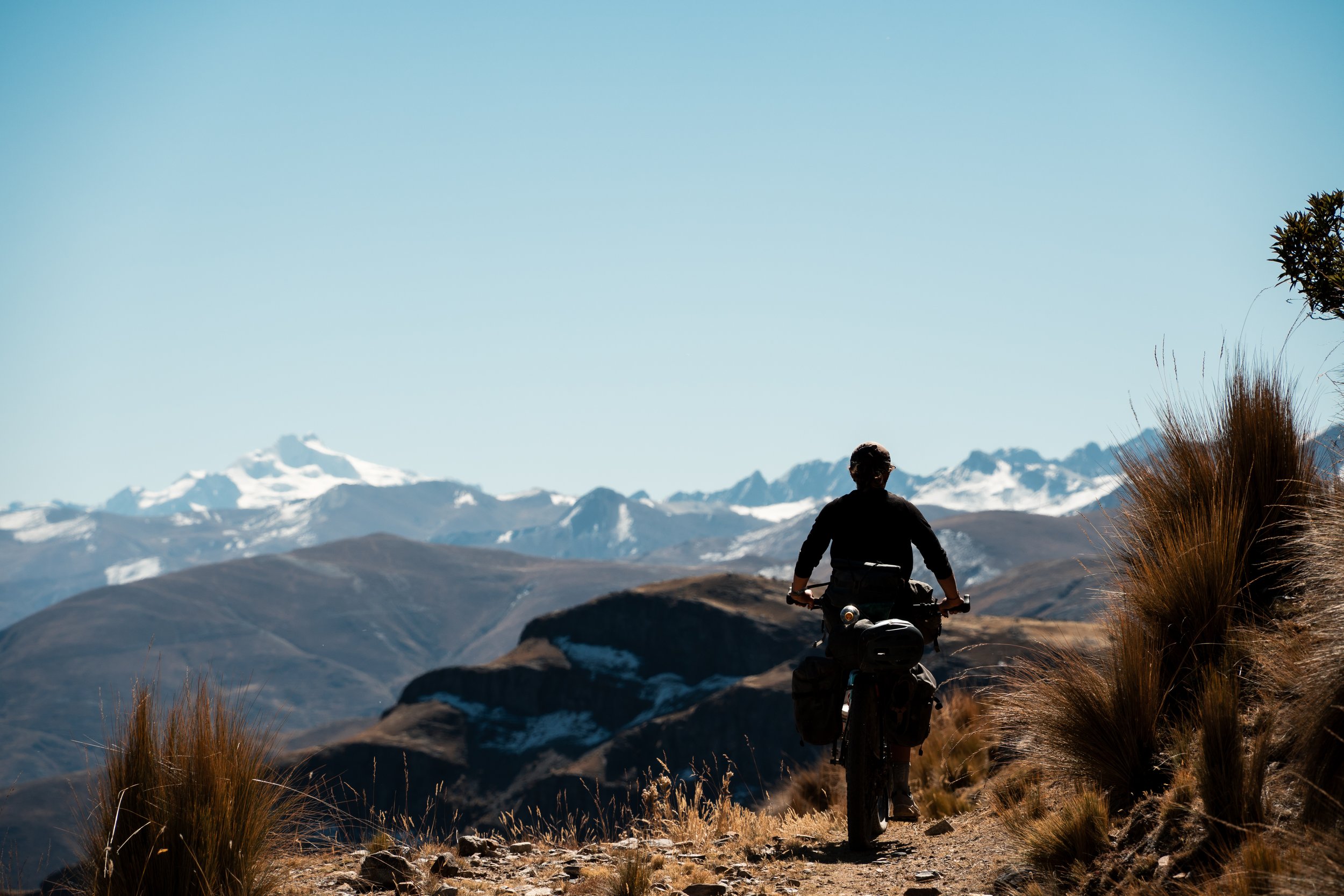
We loaded the bikes onto the bus in Calama, nearly two weeks after first arriving in San Pedro de Atacama. The intervening time had been spent ingesting as many calories as possible, and figuring out our next steps due to ongoing political upheaval in Bolivia. There were road blockades throughout the country, with people protesting the government due to high inflation and poor economic outlook. La Paz was so desperately short of medical supplies the doctors were striking to counter-protest the blockades. Reportedly multiple people had died when even ambulances weren’t allowed through. Ultimately though, we decided to return and ride the Mama Coca and Tres Cordillera routes from Oruro to Peru, via La Paz.

Descending back into San Pedro de Atacama - unlike Bolivia, all the roads were tarmac in Chile
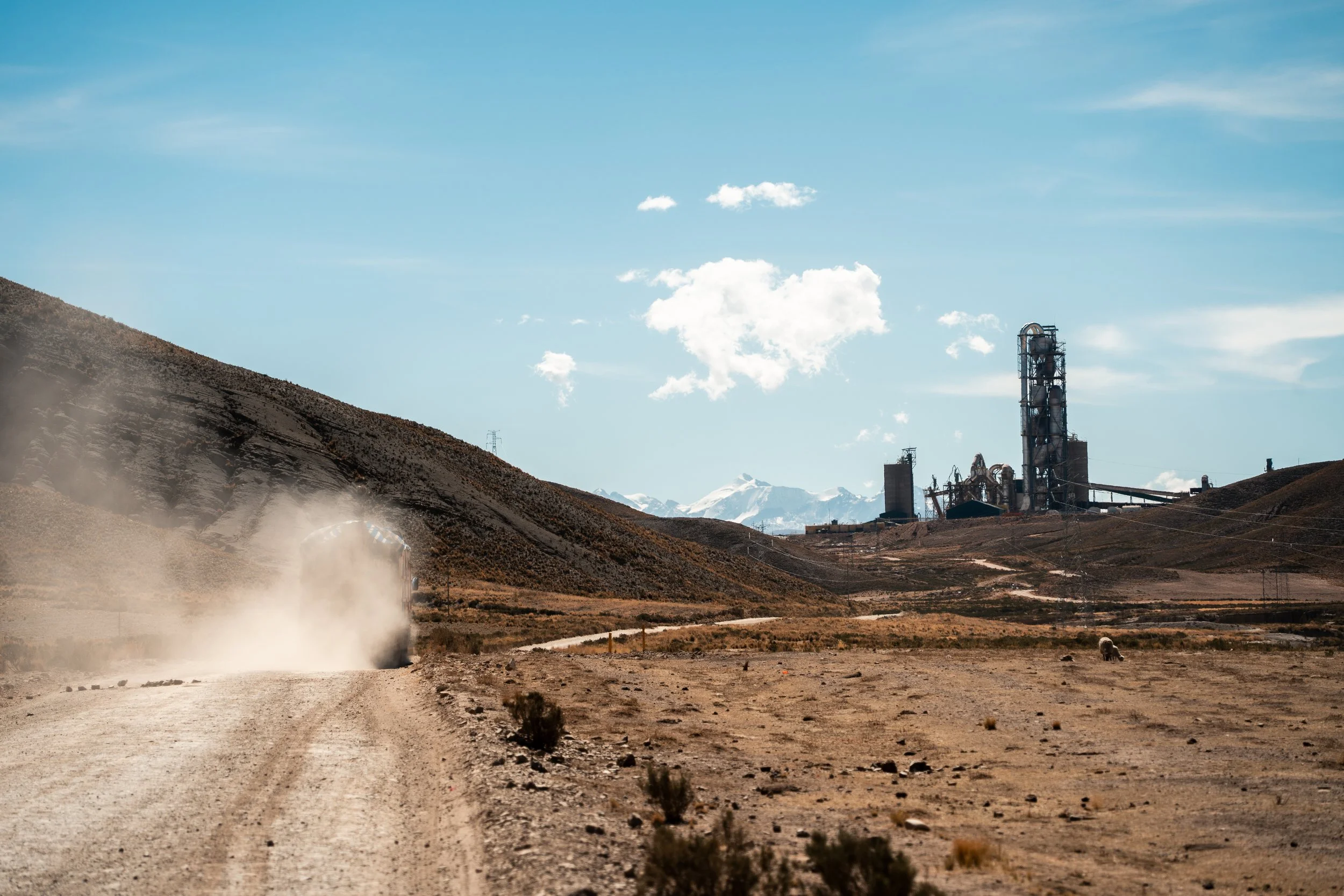
Two buses and nearly 24 hours after leaving San Pedro, we were in Oruro. The impacts of the blockades were quickly apparent, as we attempted to get a coffee but found the coffee shop had no milk or coffee (fortunately they still had instant). We rode 40km to Caracollo that afternoon, on the main highway to La Paz. The blockade must have been near, as the streets were lined two deep on either side with hundreds of lorries. At the entrance to town, groups of people held ropes up, directing traffic. We ate breakfast with a truck driver who had been stuck for 40 days in town, unable to leave. Most people we spoke to did not agree with the blockades, and they were frequently referred to as ‘mal’ (evil).
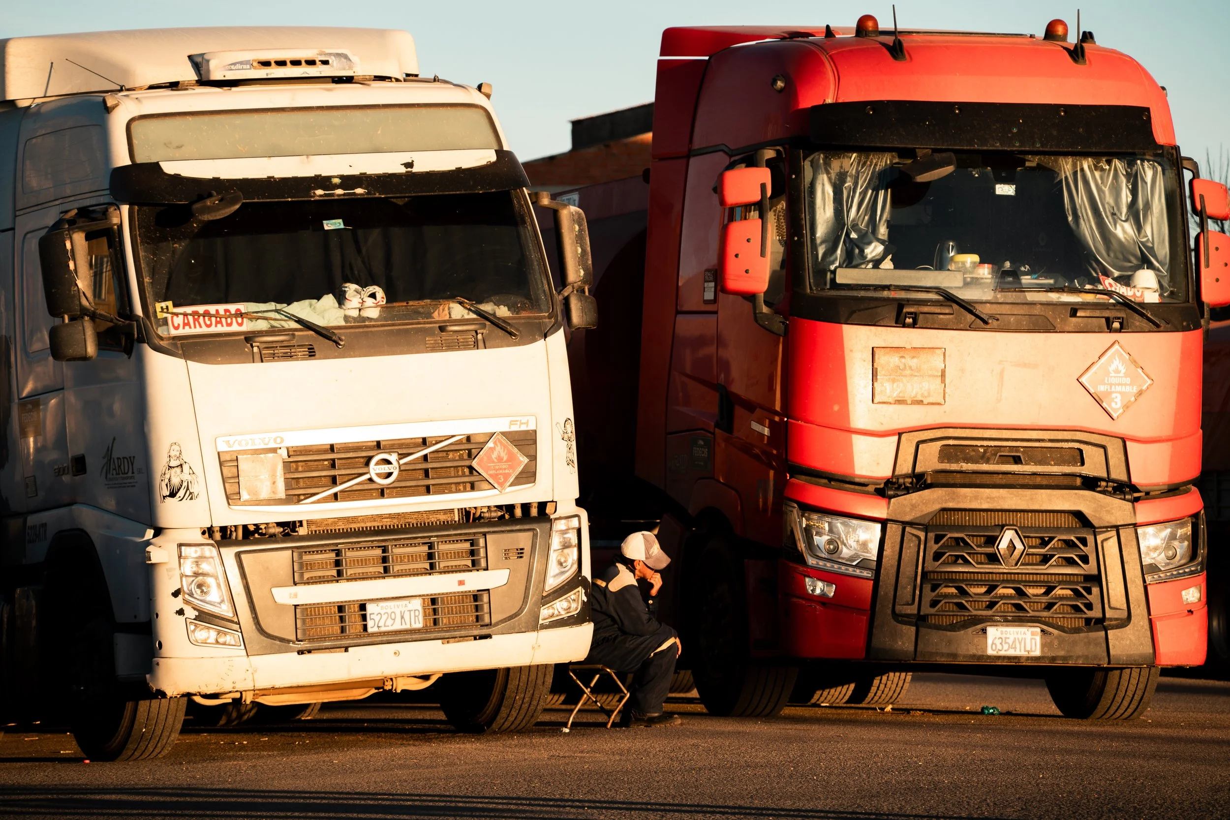
Lots of bored looking truck drivers in Caracollo.
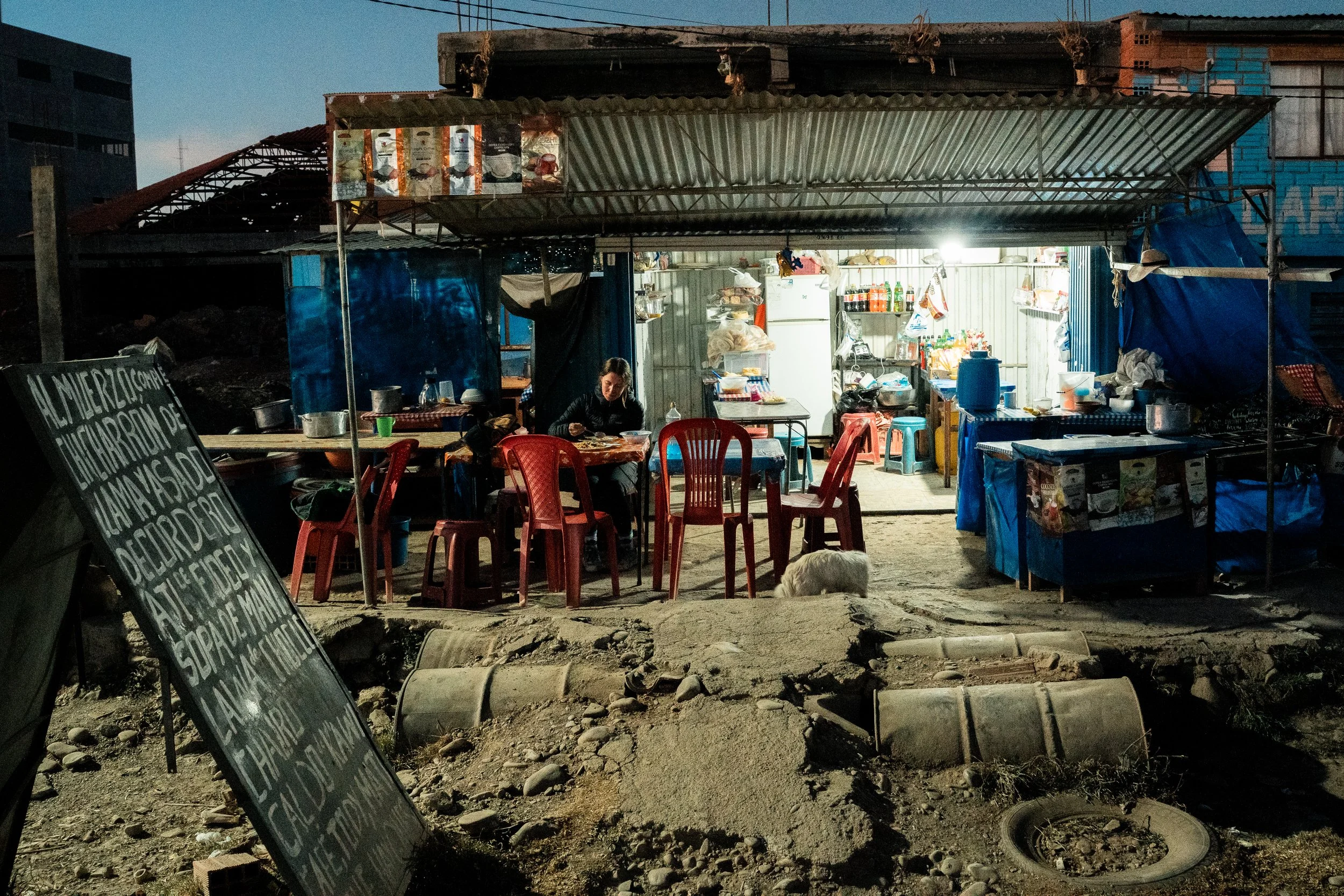
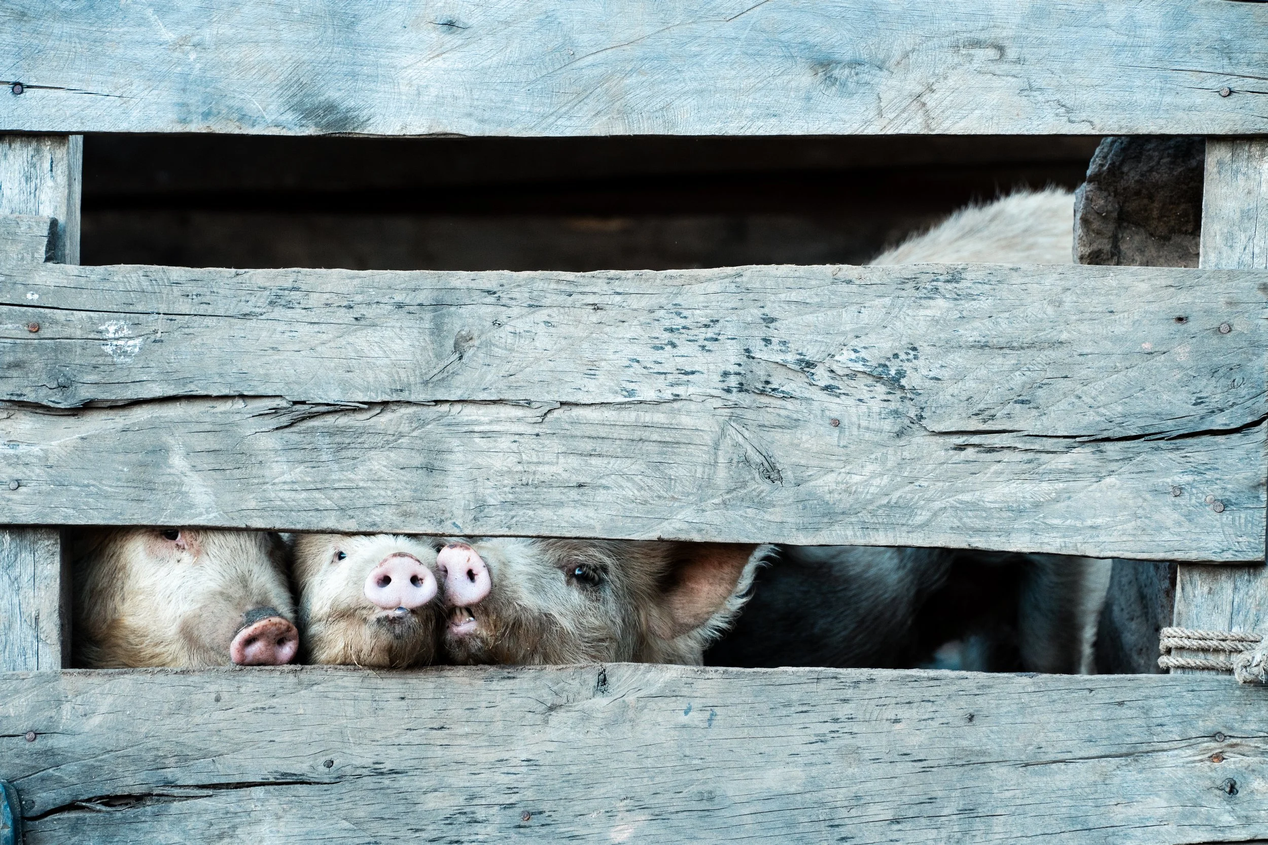
Typical Bolivian restaurant
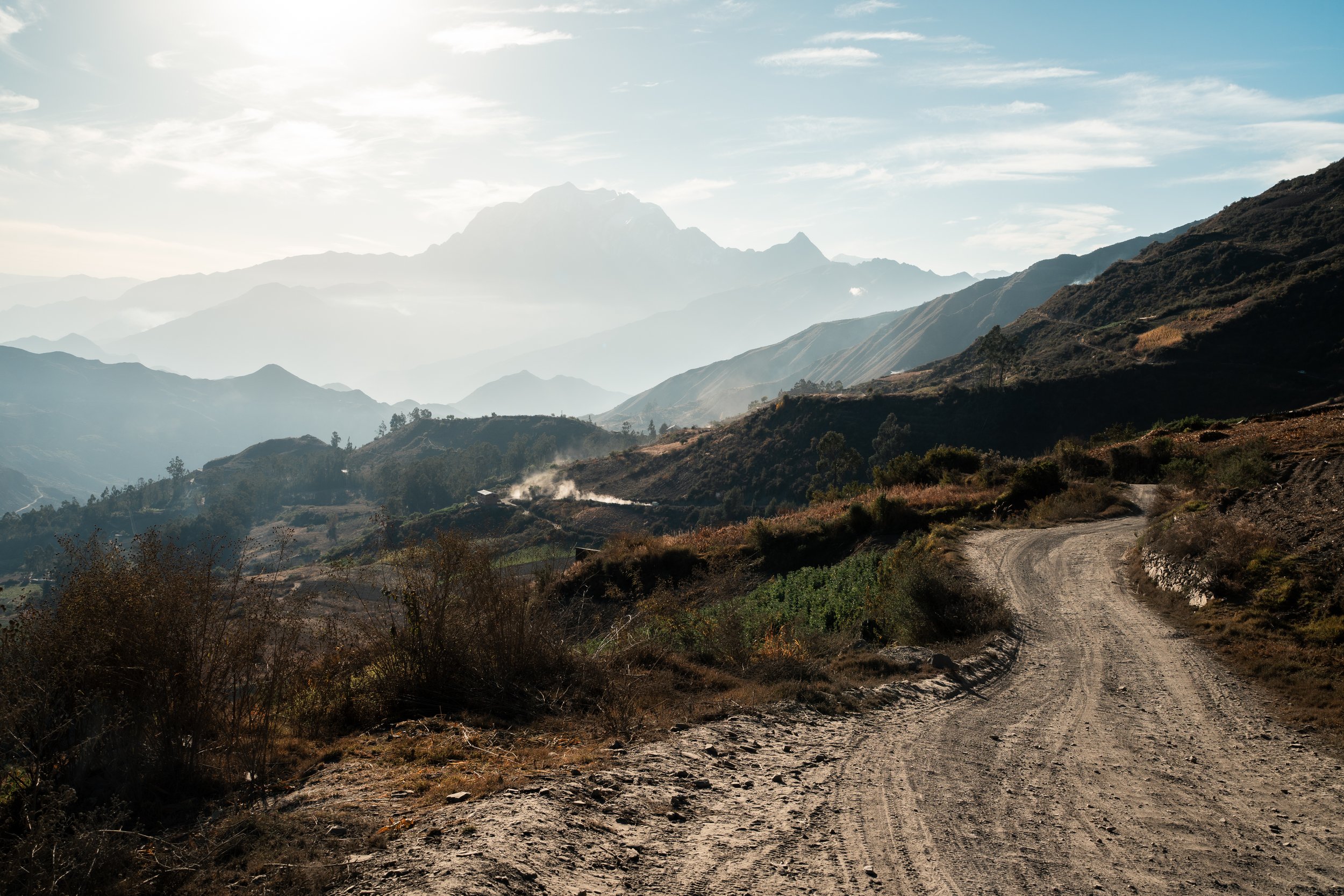
On leaving town, we realised that most traffic must also be using the mountain route as a bypass, as we shared the dusty roads with lorries, more often than not with brightly coloured hats poking out the top. We stopped to eat an cream in Condoriri and watch a Sunday football tournament. There was not a single blade of grass on any of the three very dusty pitches they were playing on, and we had quite a few cameras recording us as we stood on the sidelines. Just as we pulled out of town, my bike began to make an unsettling noise. Lauren was able to spot a broken spoke on the rear wheel, likely a result of the rough handling putting the bikes in the buses. I had never repaired one before, but luckily it was all quite straight forward and within an hour I had replaced it with a spare and we were back on the road.


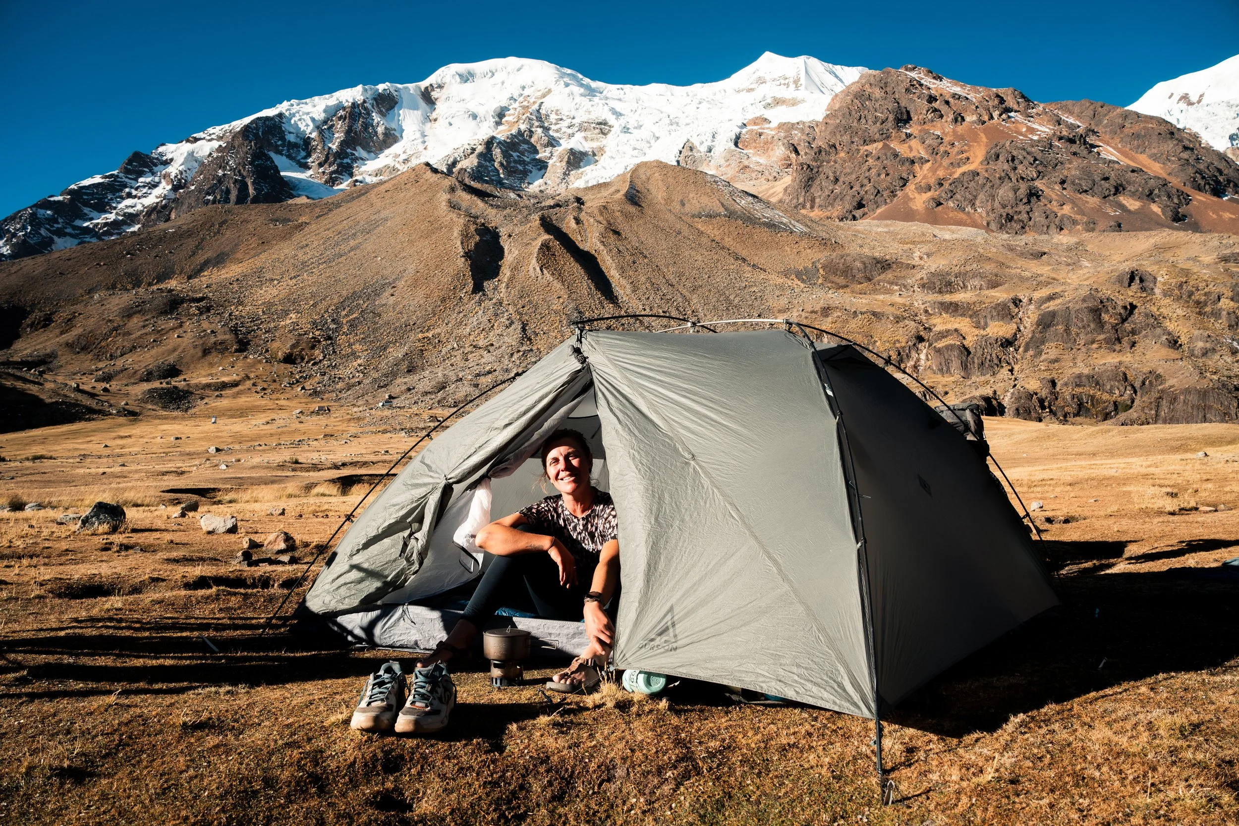
Seeing the snowy peaks of the Andes get closer slowly through the day was a welcome sight, as we aimed for Tablachaca at the base of them. We checked into an alojamiento in town, only to be told there were no toilets available and we had to leave by 8am because of the blockades. This left us utilising a bucket and a bottle overnight, and we only subsequently realised there was another alojamiento nearby.

A blocqeo

Breakfast
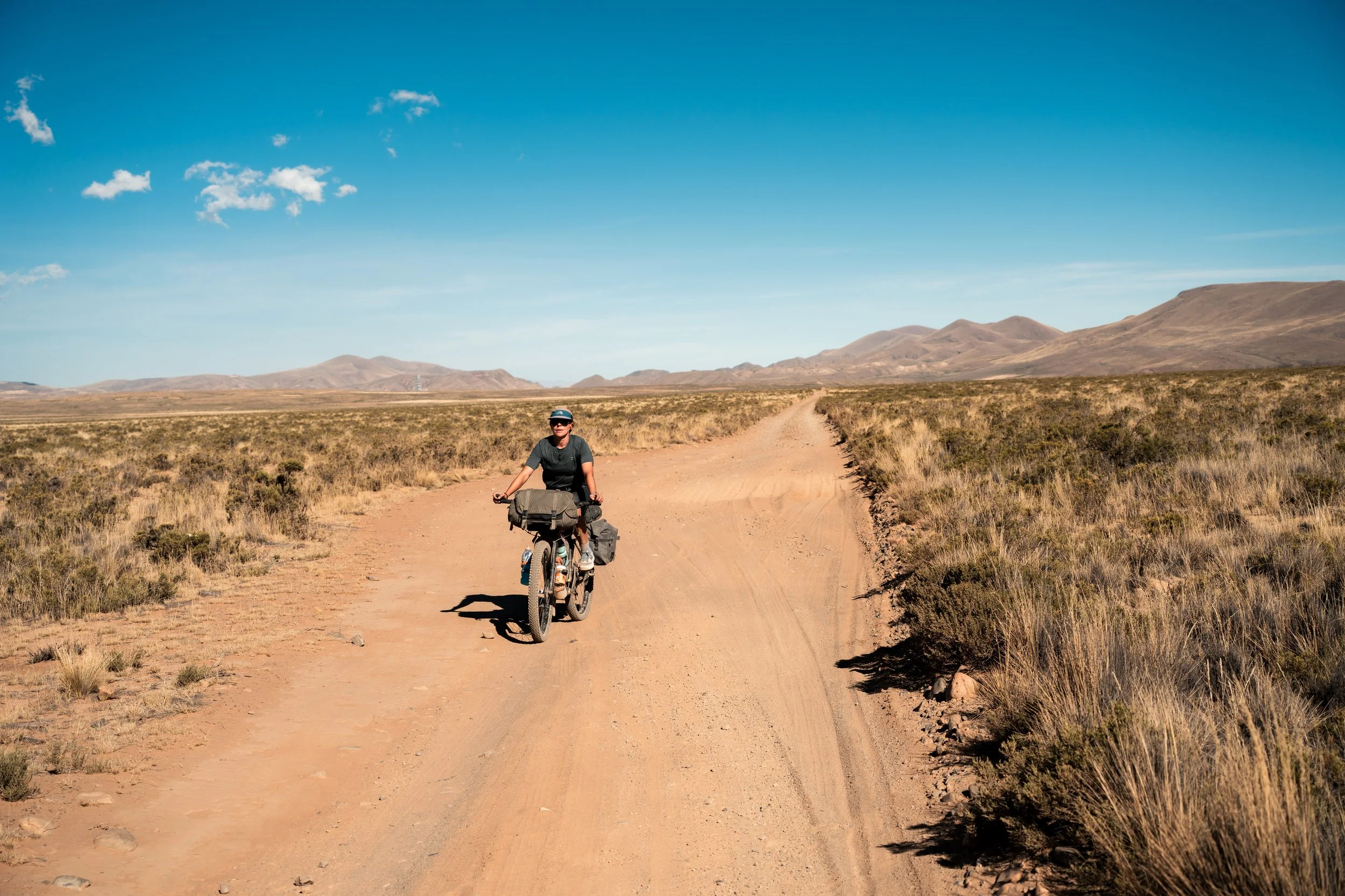
We watched a small blockade turn around a single truck as we ate breakfast in the towns plaza in the morning, but within ten minutes the people had dispersed. Immediately we were climbing, with impressive views over the canyon complex behind us, as the flat altiplano simultaneously rose into mountains and dropped into valleys. A small first climb was followed by a descent to the valley floor, where we were let through another small village with a rope hung across the front without issue. It was 2pm before we regained the elevation we had lost with the descent. We filled water from a garden hose in Rodeo and made small talk with two guys in town who insisted that Lauren was my boss… or my mother, we couldn’t quite get it clear.

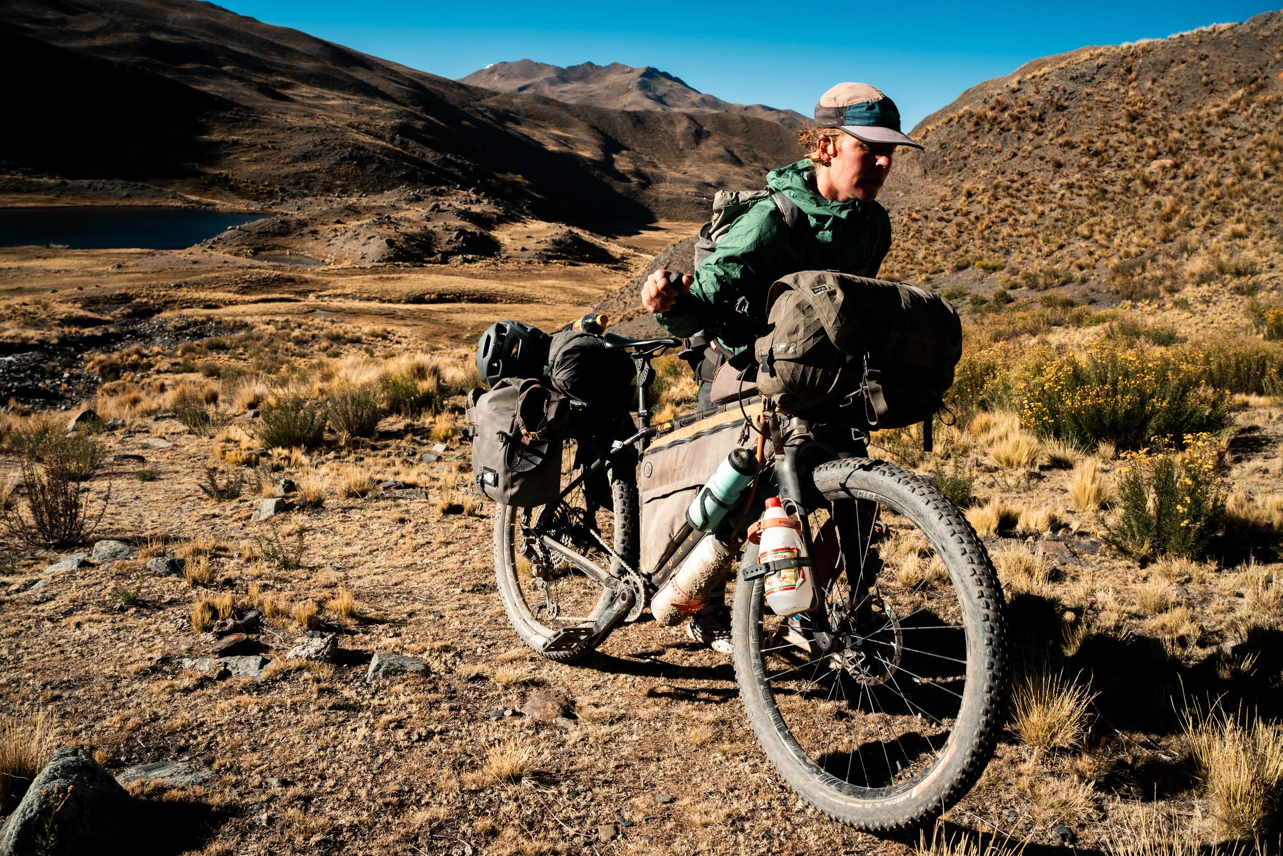
Looking for water in Rodeo

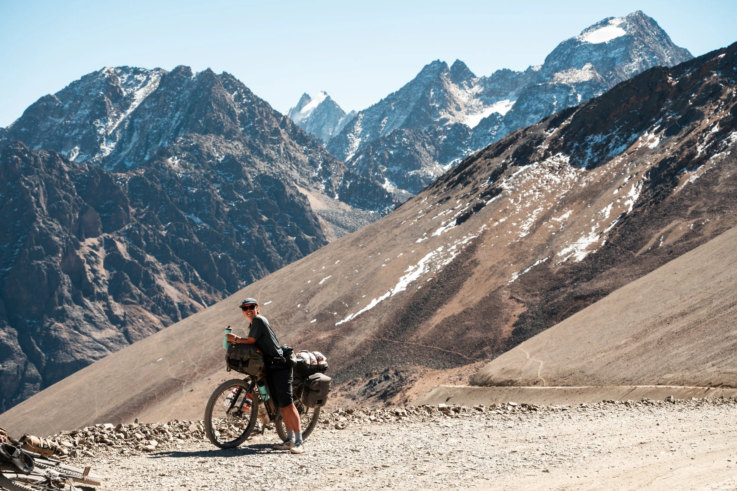
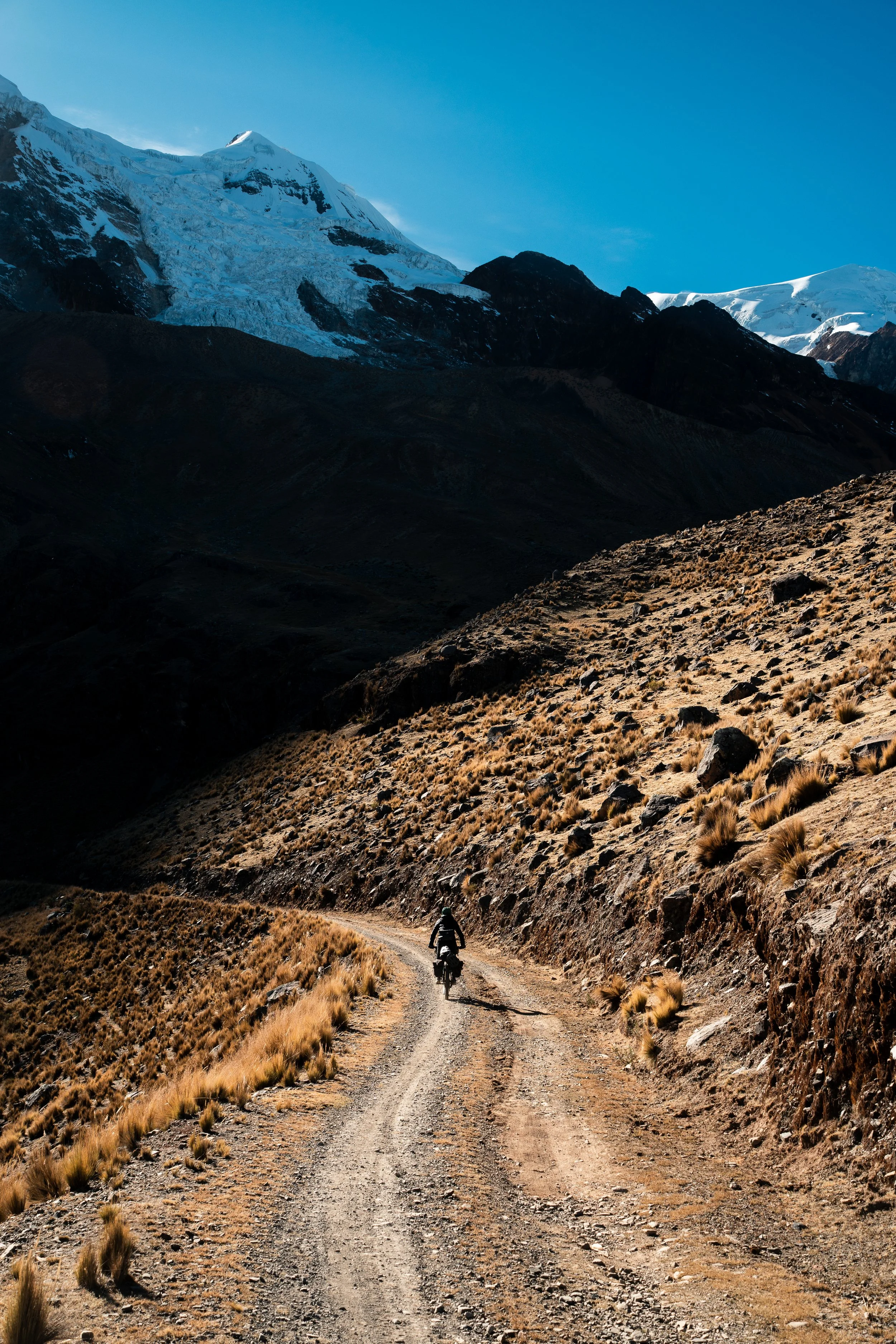
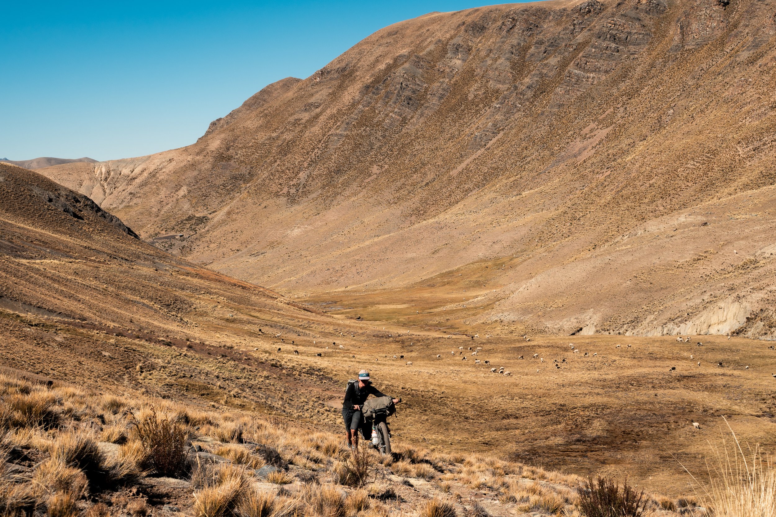
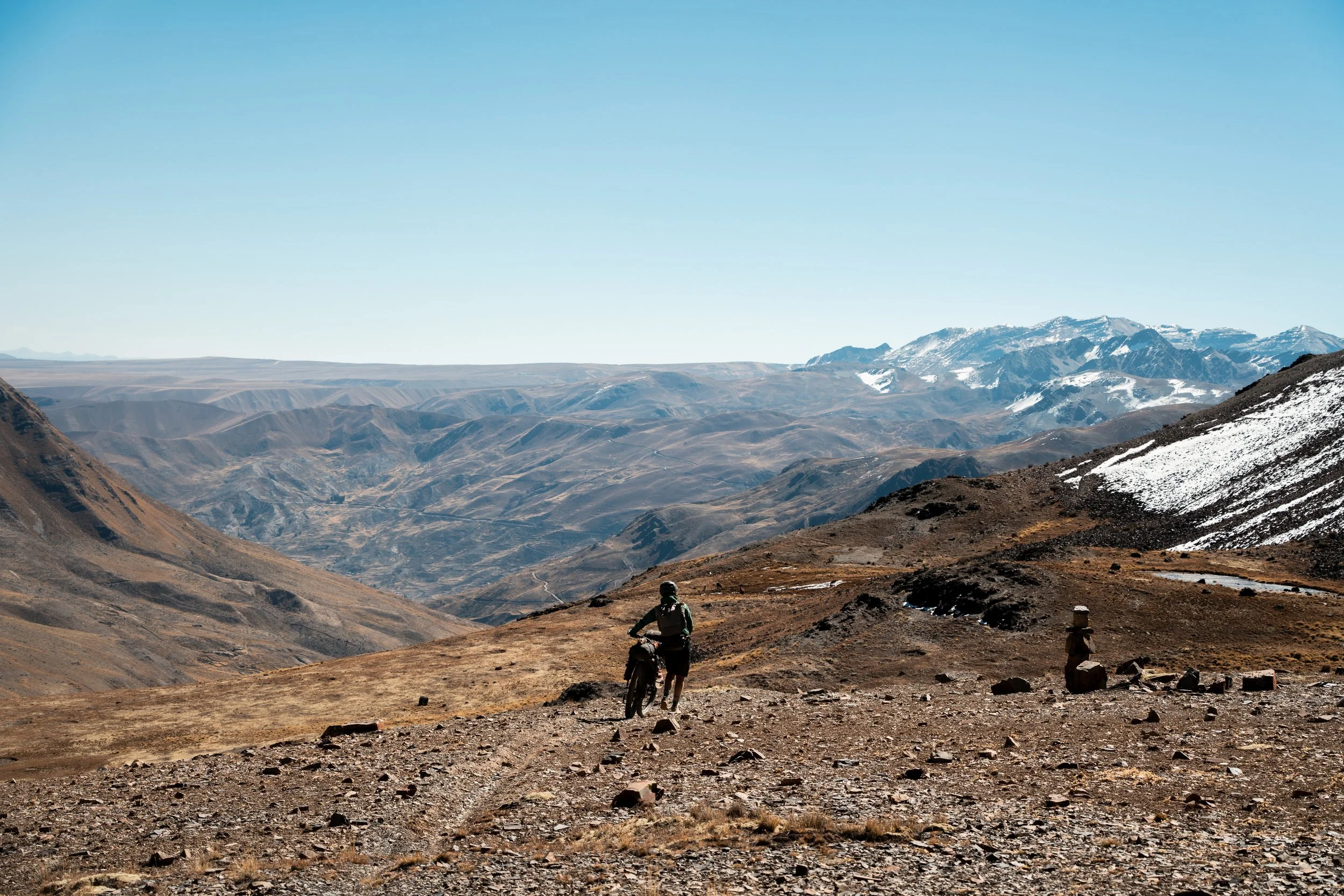
As we ascended, we began to pass open areas of valley, with llamas grazing and small lakes. This scenery was much more to our liking than the Altiplano, and our spirits were the highest they had been in weeks. At 4850m we came across our first potential campsite, at a lake under some glaciers. Unfortunately there was a noisy mining operation there, making it an unappealing stop. We had about 90minutes of daylight left, so we pushed on over the next pass, a few hundred metres of climbing to our high point of the trip so far, 5125m. We had been riding well and feeling acclimatised, but as we hit 5000m, we both suddenly gave out and spent most of the next hour pushing the bikes up the road to the pass. By this point the sun was behind the mountains and darkness and cold were setting in quickly.

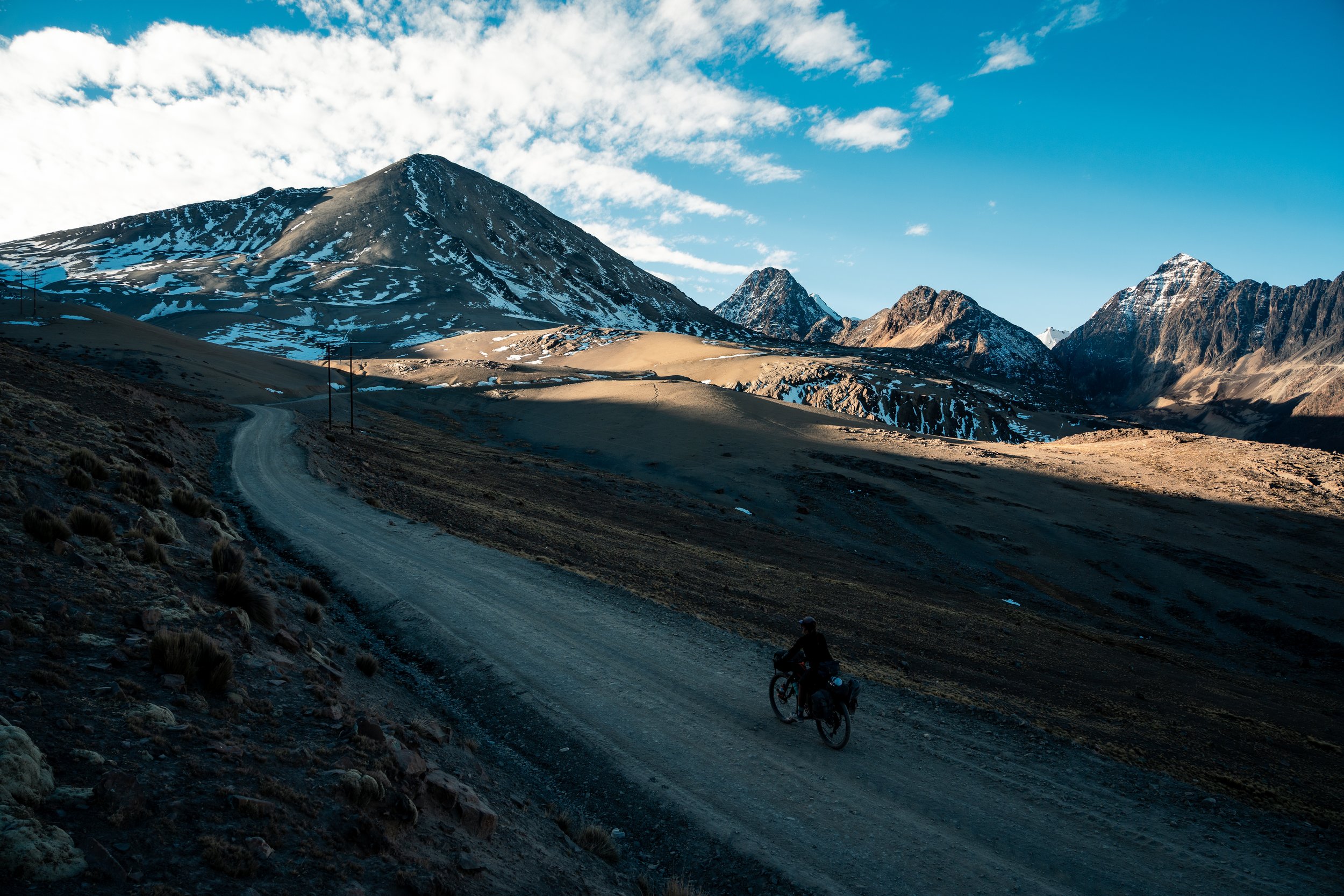
Looking down to our campsite

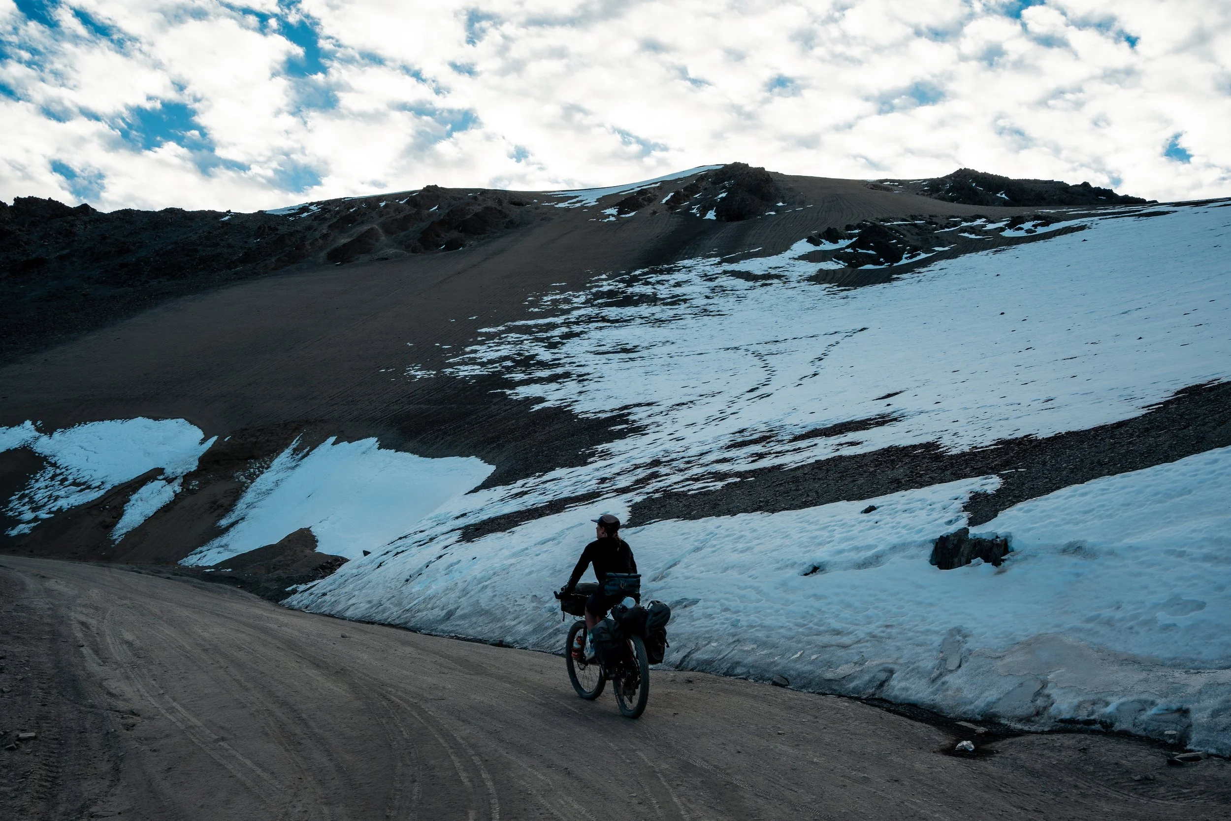
With painfully numb fingers and on the verge of darkness, we made it to the lake and managed to set the tent up under torch light. This was our highest camp so far at 4850m, but we were pleasantly surprised with how warm it felt. Of course this was only relative to the Altiplano, as all our water still froze overnight.

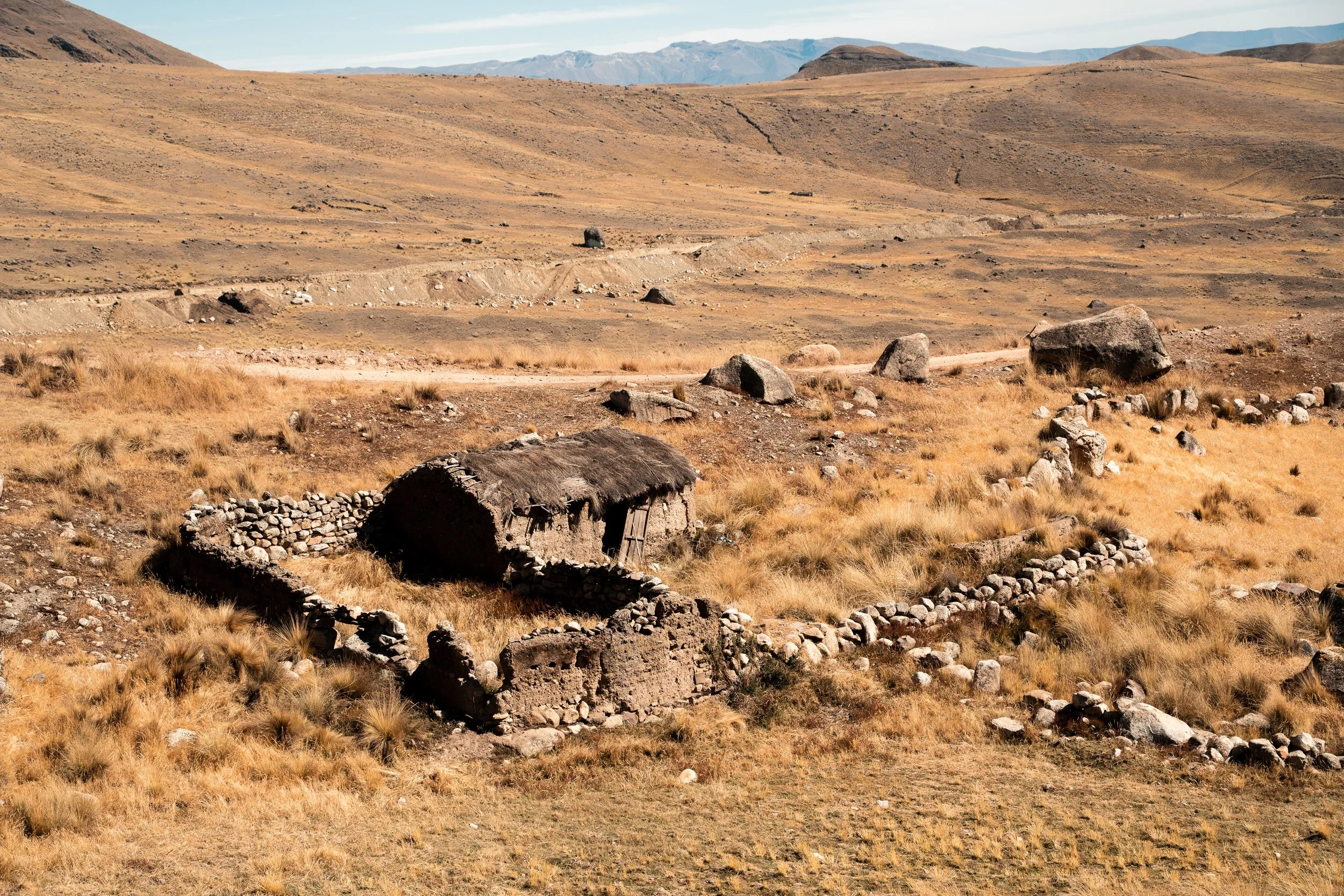
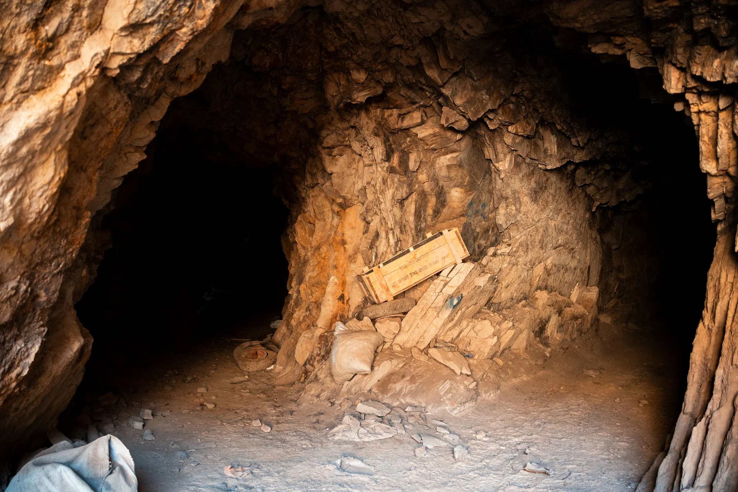
We took a slow morning, exploring some of the mines nearby. The mountain sides were littered with small entrances, less than 6ft tall. Many appeared now abandoned, but some were in use. There was one very close to our camp, so we went inside as far as we dared. Cracking tree limbs propped walls apart and roofs up, a hand pulled mining cart missing a wheel was in one tunnel, and deep shafts disappeared into the black beneath us. I couldn’t help but wonder at how hard this work must be, manually digging into mountains at nearly 5000m elevation.
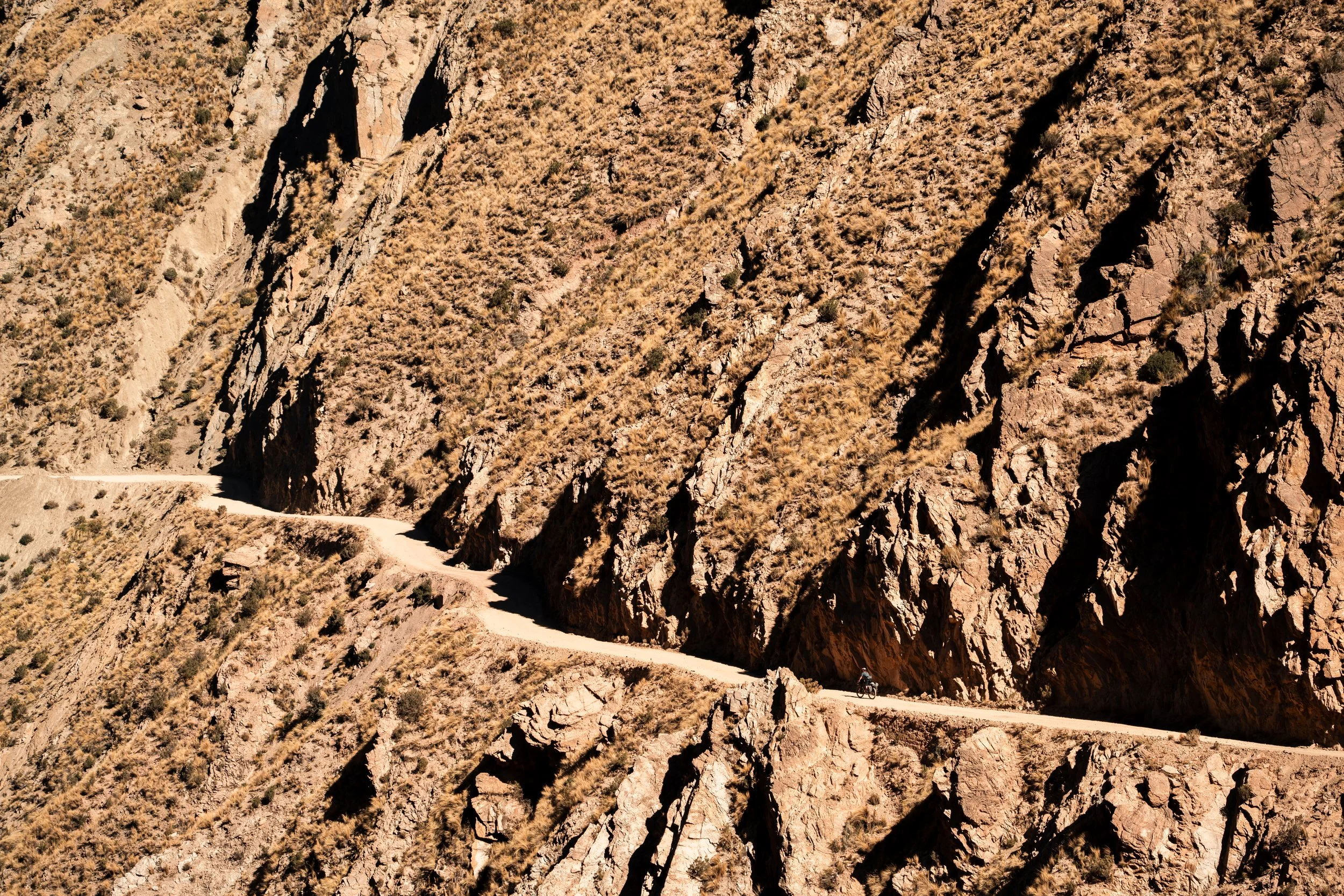
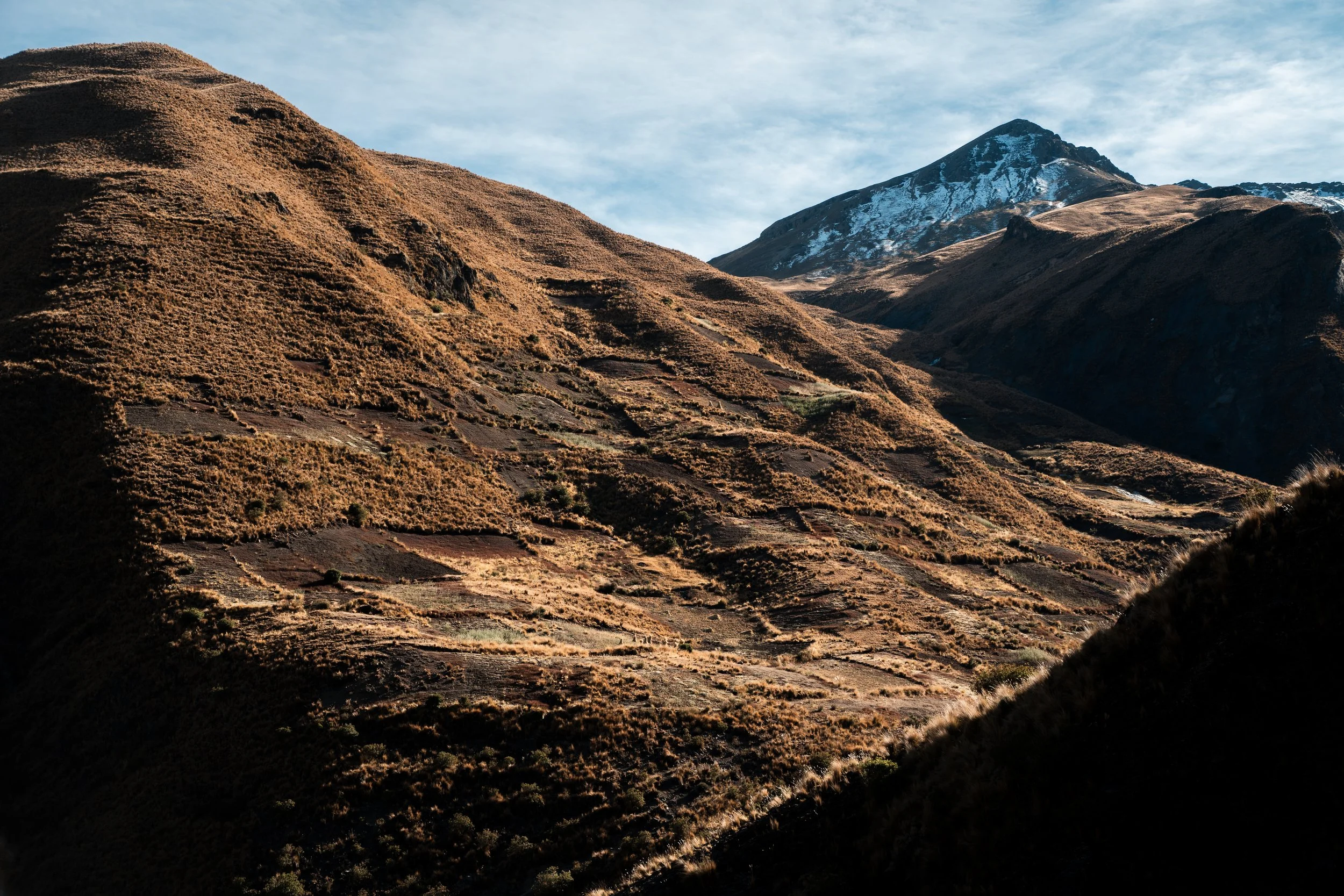
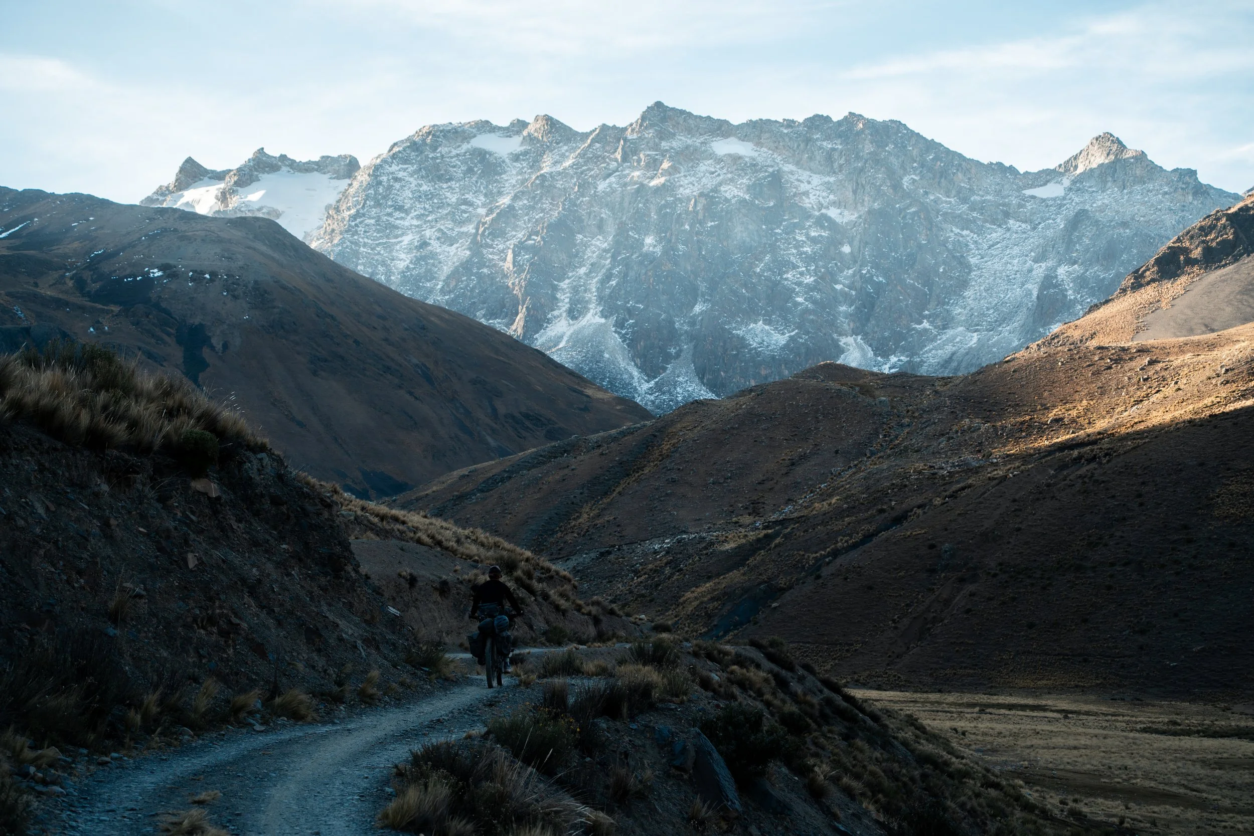
The riding took us over two passes in the morning, both just shy of 5000m, with pleasantly ridable gradients. The valley in between was typical of the high Andes, with a few old farm buildings and llamas. Coming over the second pass we had our first views over the massive Rio La Paz canyon.

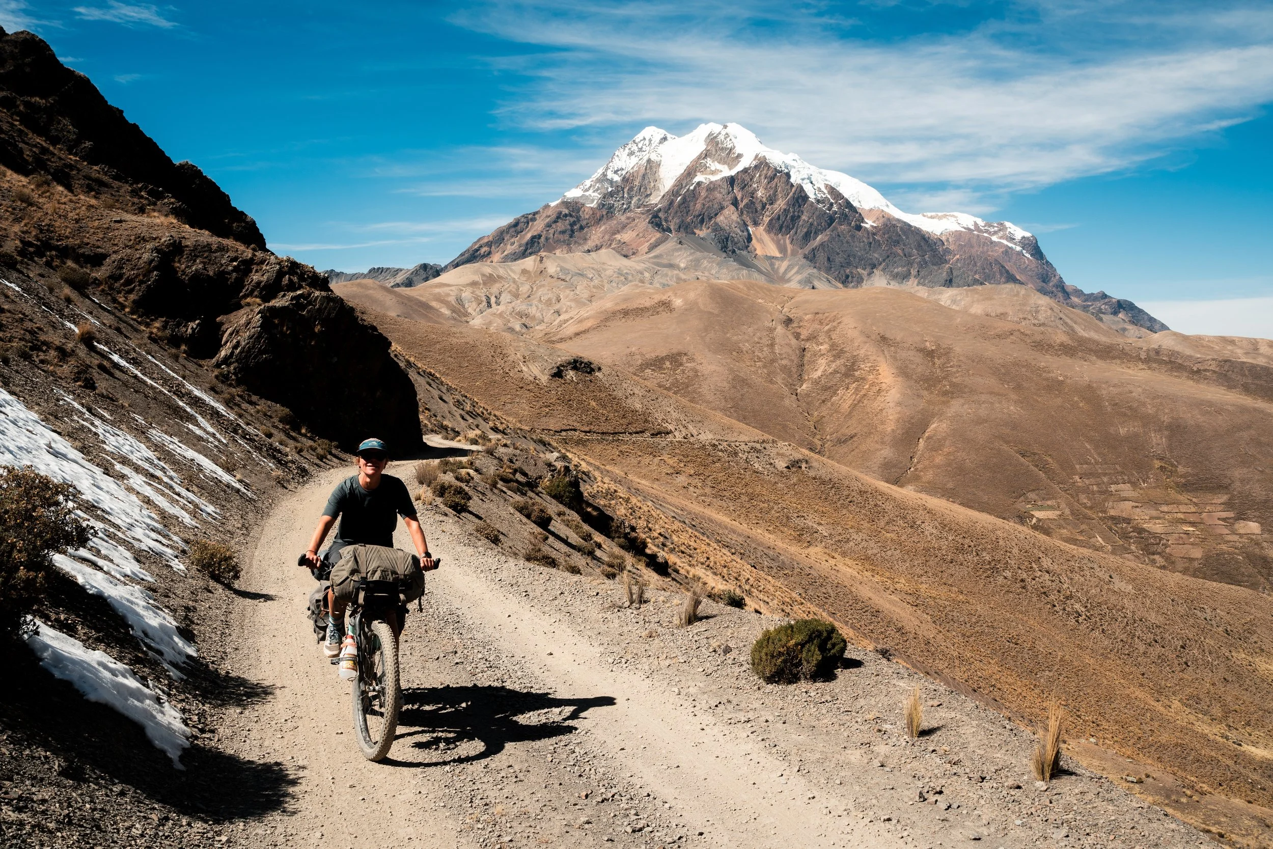
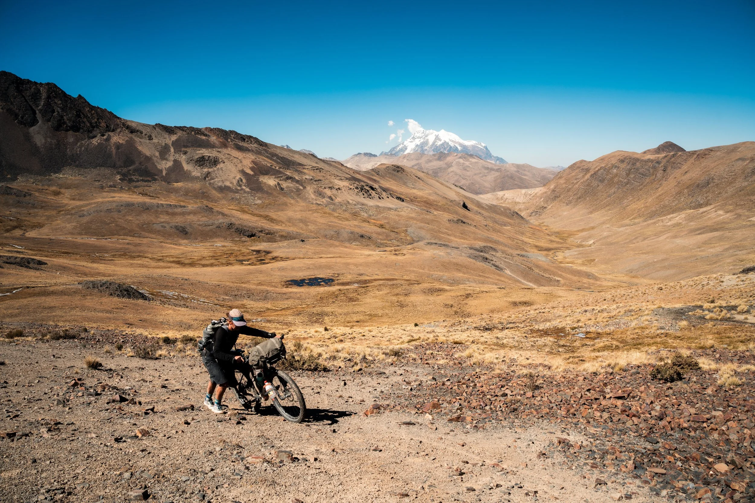
Illimani dominated views from the moment we entered the canyon.
The river was over 3000m below us, and the mountain Illimani dominated the view in the distance. Our next few days would be spent descending to the river, and then climbing up to sidle around the flanks of the mountain, which looms over the city of La Paz. Early in the descent we had typical llama farming, but as we descended, more farmlands began to pop up. Potatoes were drying early on, but soon fields of green leafy vegetables appeared. The afternoon sun cast a warm light as we continued to descend, every field having smiling people waving at us, the small villages teeming with life. The school brass band was out marching as we passed through Viloco. This was such a stark contrast to the cold, lifeless Altiplano, and we loved it.
Farmland!
I had suddenly lost all my energy near the top of the second pass, and as we found accommodation in a small family-run Cabana, I was beset with a horrendous cold, forcing some rest days whilst I recovered. Luckily for us it was beautiful surroundings, with palm trees, good food, and canyon views.
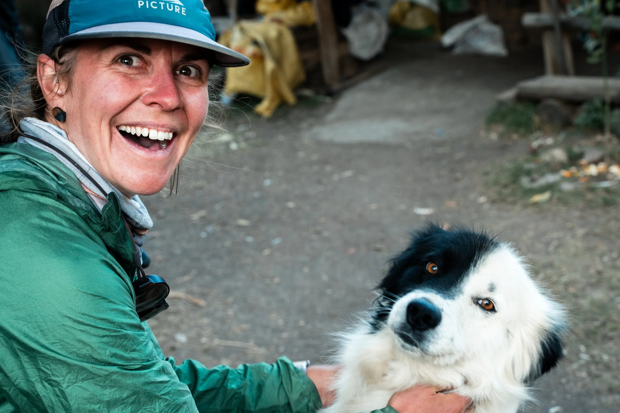
Lauren was pleased to meet Jackie.

Our views for the rest days.
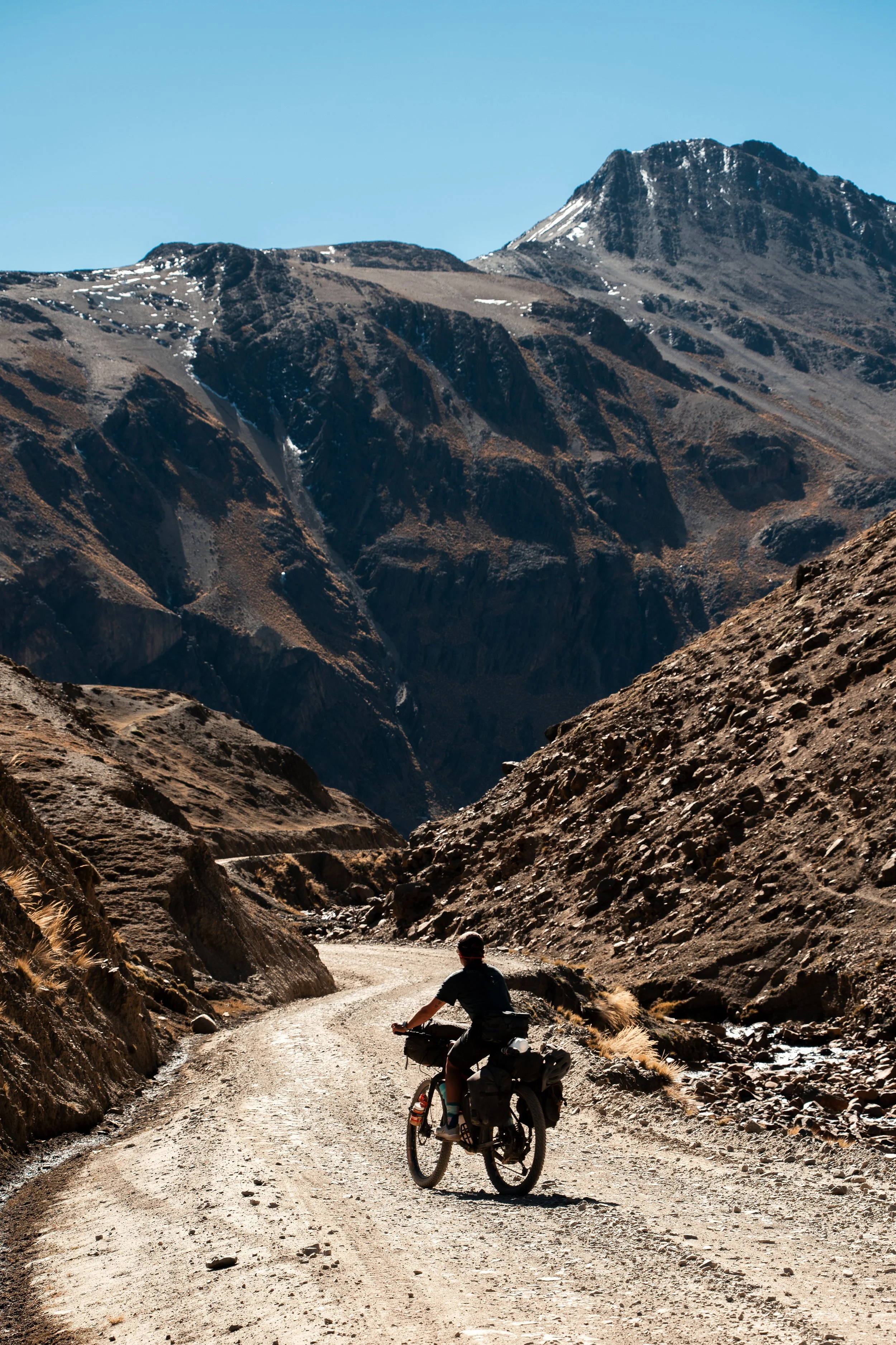
After four nights, I had recovered enough to continue the ride and we had to say goodbye to Laura, her young daughter Johanna (who had become accustomed to coming to our cabana after school to scrounge for snacks), and their dogs. We continued to descend, from 3000m to the river at 1600m (with 500m of climbing in between). Not far below the cabana, the farms gave way to cacti and shrub, and there were no further settlements or water.

At the bottom the temperatures were over 30ºc, and we sweated profusely as we began the long climb out. We were keeping an eye out for campsites, but the road wound steeply up the side of a ridge. My illness caught up to me, and I struggled pushing my bike through the afternoon. Eventually we came to farmland, and before we could find a tent-spot, we were at the small village of Cotaña (1000m above the river). Surprisingly, there was an alojamiento in town, a restaurant, and multiple tiendas. This was all welcome news. Sitting and drinking a Coka Quina just on arriving to town, a group of local ladies were apparently so worried by my appearance they tried to take me to see the local doctor. Luckily Lauren returned from scoping out the village to tell them all I needed was fluid and a sit down. We had a delicious silplancha for dinner (steak, fried egg, rice, and chips), with the typical Bolivian situation, where a restaurant will have multiple menu items, but only serve one each night. Two ice creams, 1.5L of soft drink, and a packet of biscuits later, and we both felt recovered enough.

The Rio La Paz

Little opportunity for camping.
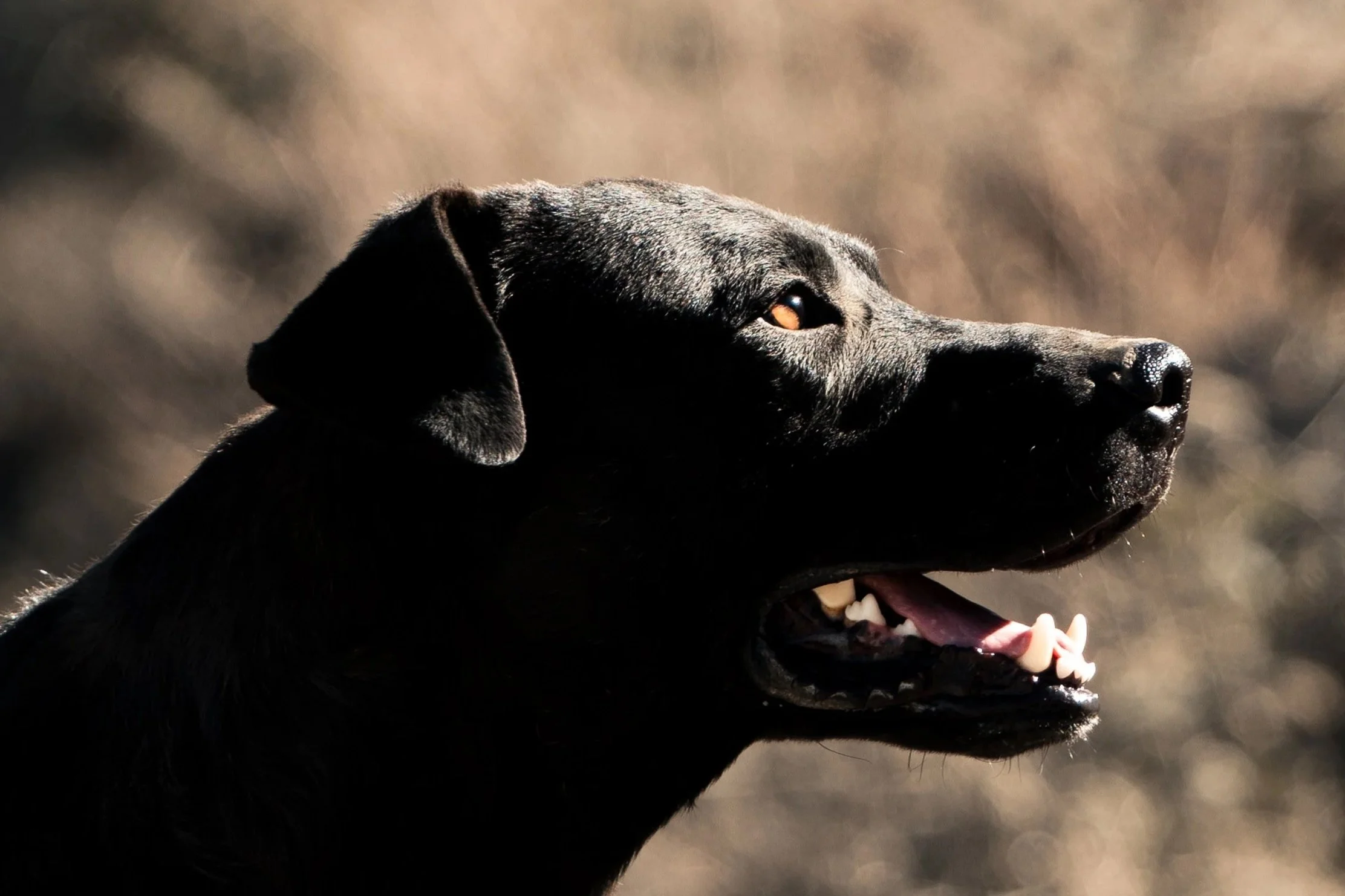
We left town early the next day, knowing we still had over 2000m to climb out of the canyon, thankful we had already ascended out of the scorching temperatures lower down. On the outskirts of town, a large black dog came running up to us, wagging his tail. We had also seen him when we first entered town, as he immediately jumped up on Lauren as she rode. He also emerged from an empty room in the alojamiento at 5am when I went to use the bathroom, and had to be pushed back to keep from coming into our room. He was very friendly, and appeared determined to follow us. There was little we could do, as we slowly climbed and he ran ahead of us, stopping to check we were coming, or at branches in the road to await directions. At lunch he refused to eat the tin of tuna or spam we tried to feed him, which I took as confirmation I was right to do the same when Lauren tried to feed them to me.


Nearing our campsite
By evening we had passed the last village, and turned off the dirt road onto a rugged double track, taking us the last 350m of climbing to the pass. We pulled off to set up the tent in a small gully, the dog still with us. He now scoffed down the spam we had previously offered. As soon as the tent was out, he was trying to get inside. We fought to keep him outside, and he fell asleep just outside the door on my side. Just as we were getting ready to sleep ourselves, he woke up and tried to get inside again. He was about 40-50kg, and it took all my body weight to keep him out. He lay down again, but I could feel him shivering against me through the tent in the below freezing temperatures. We repeated this routine every hour to begin the night. At one point I noticed he wasn’t outside; a few seconds later something crashed into the tent on Laurens side of the tent, and grabbed her calf. He had put a large hole in the tent fly trying to get in. It wasn’t long before he was back trying to get in my door, which we had left open to try and prevent this happening. Unfortunately I had barely gone back to bed when he decided we weren’t keeping him out any longer, and he put his head through the netting on the tent inner. I struggled to push his head back out, and open the zip to open the door to prevent further damage. Accepting we had lost, and not wanting to risk further damage to the tent, he clambered in and planted himself between us, immediately asleep and snoring.
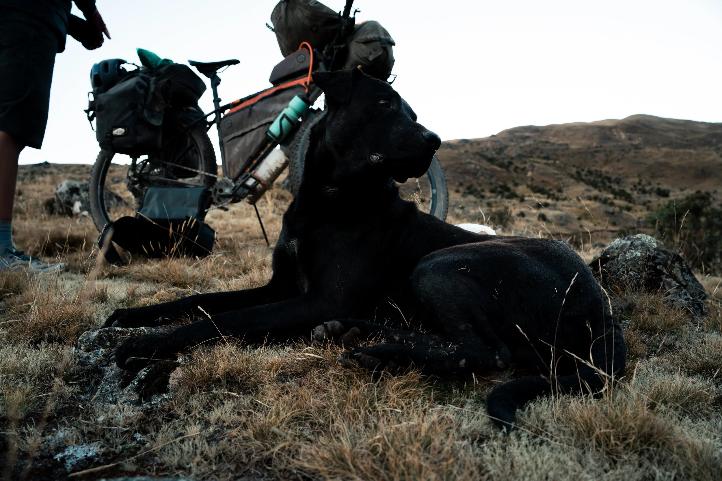
Our camp, and the hole in the tent.
We gingerly got him over our quilts and inflatable sleeping pads in the morning, and decided (much belatedly) that we would have to encourage him to return home. We had no food for him, and couldn’t risk damaging our equipment further (not to mention we would soon be in La Paz). We were camped just below Illimani, so it was a long wait for the sun to rise and bring temperatures above freezing. It took an hour, but we finally managed to stop the dog from following us, and the last we saw he was slinking over a field far below us. The moment brought back strong childhood memories of watching Pokemon when I was 10; the clip is a very accurate representation of the moment.
As we paused to rest on the pass, a strong cold wind came up. I reached to put on my wind jersey, but it wasn’t there. Shit. I realised I must have dropped it when I took it off near the bottom of the climb. Leaving the bikes, we scrambled down the hillside, and luckily it was where we thought it might be. We walked back up the road to avoid the scrambling. At the first hairpin, we saw a large black dog, just off the road. It walked off behind a knoll, away from the road. Was it THE dog?? Not taking chances, we retreated and climbed behind a small ridge, and never saw it again.

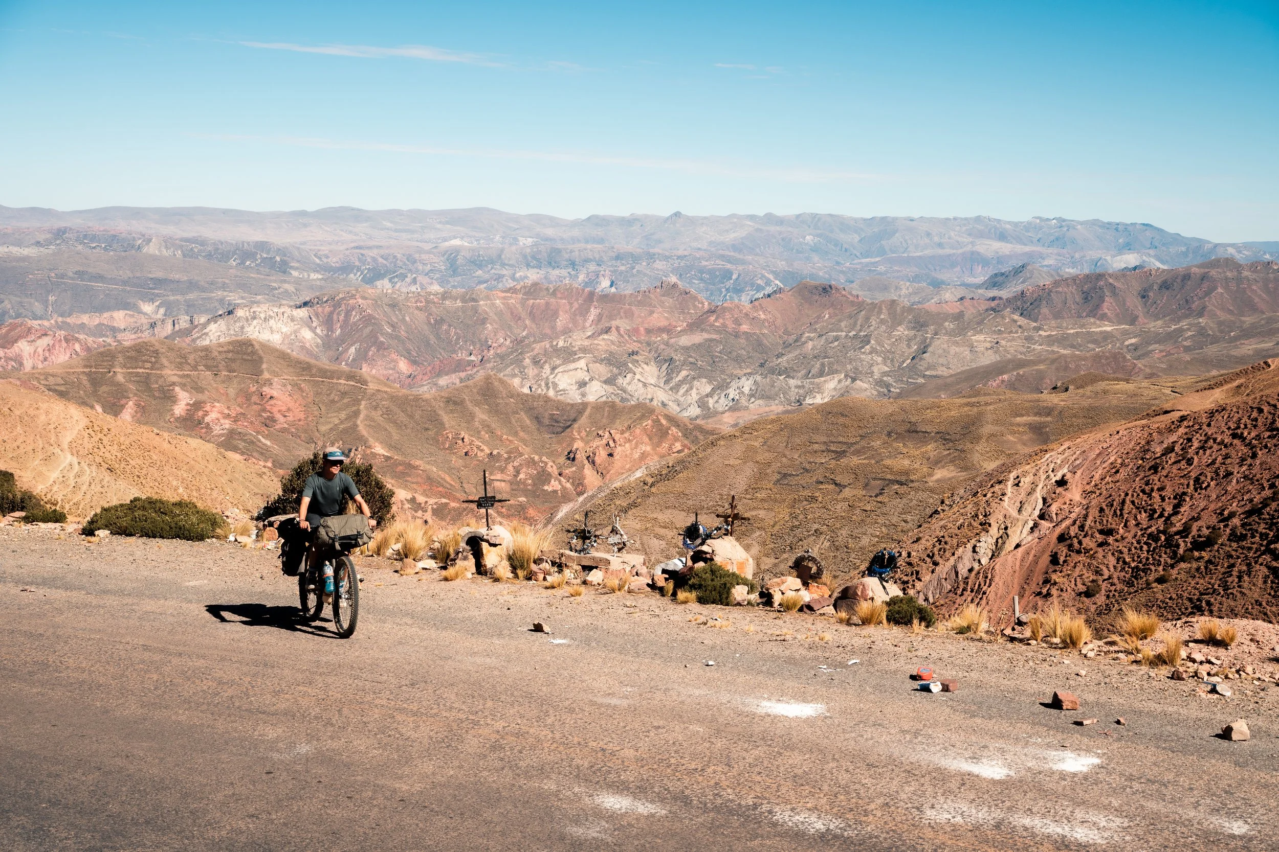
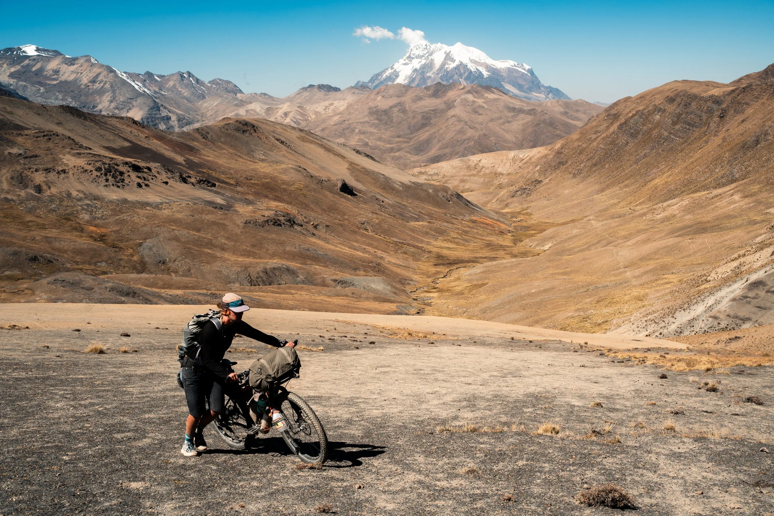
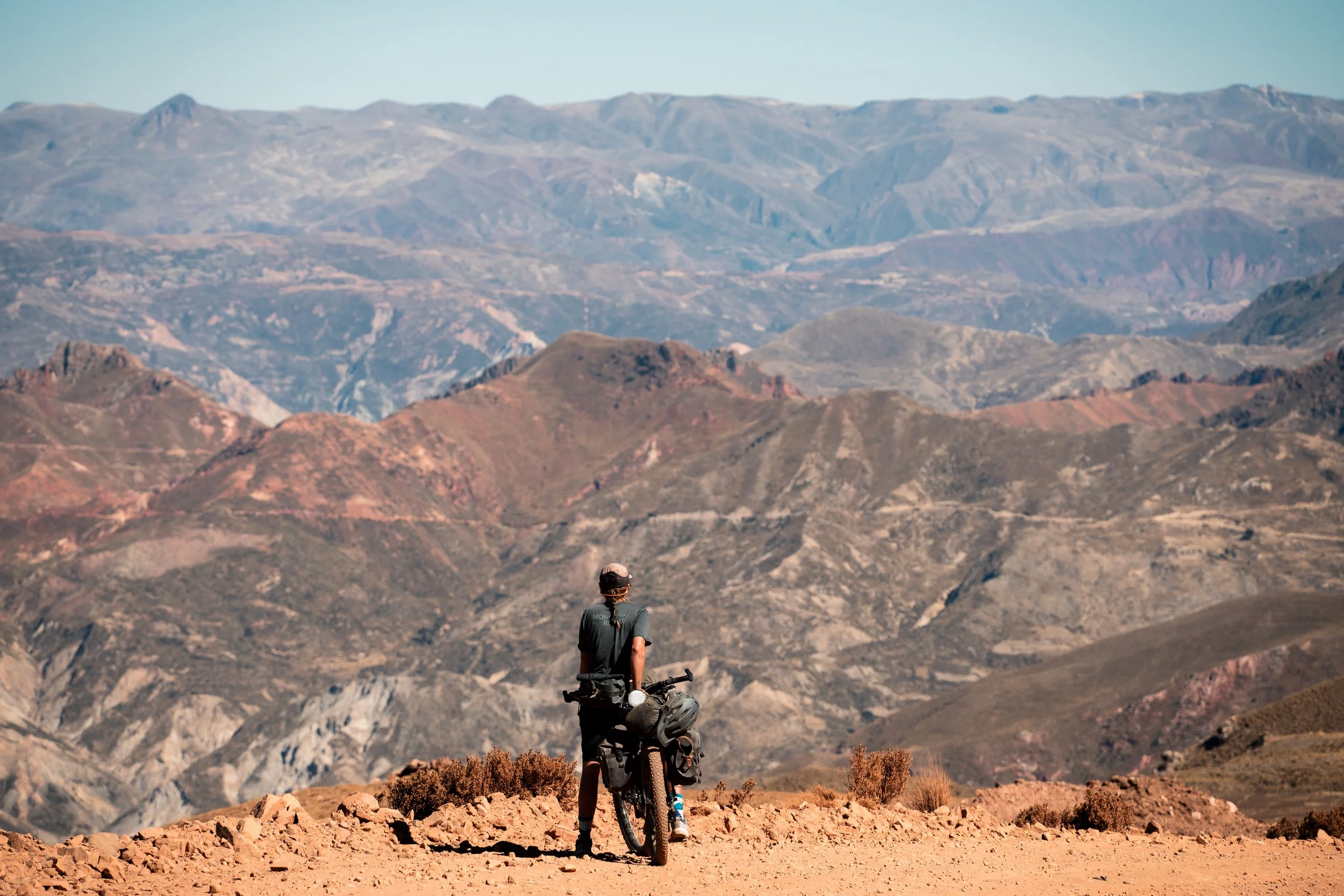
Last views over the Rio La Paz
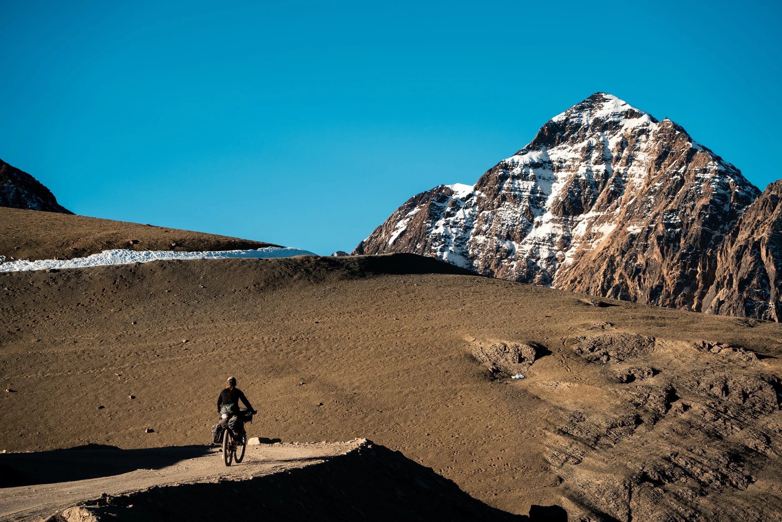
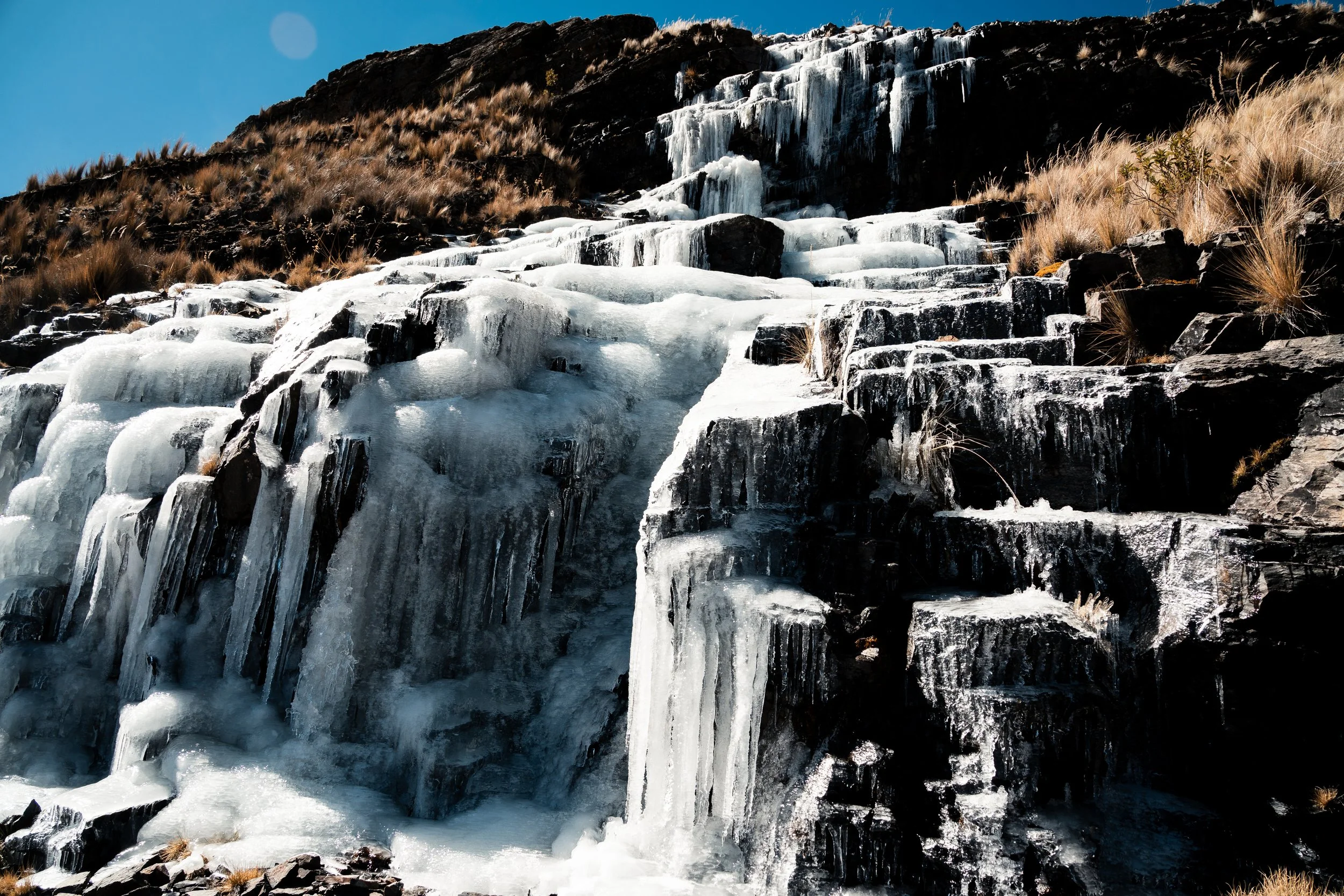
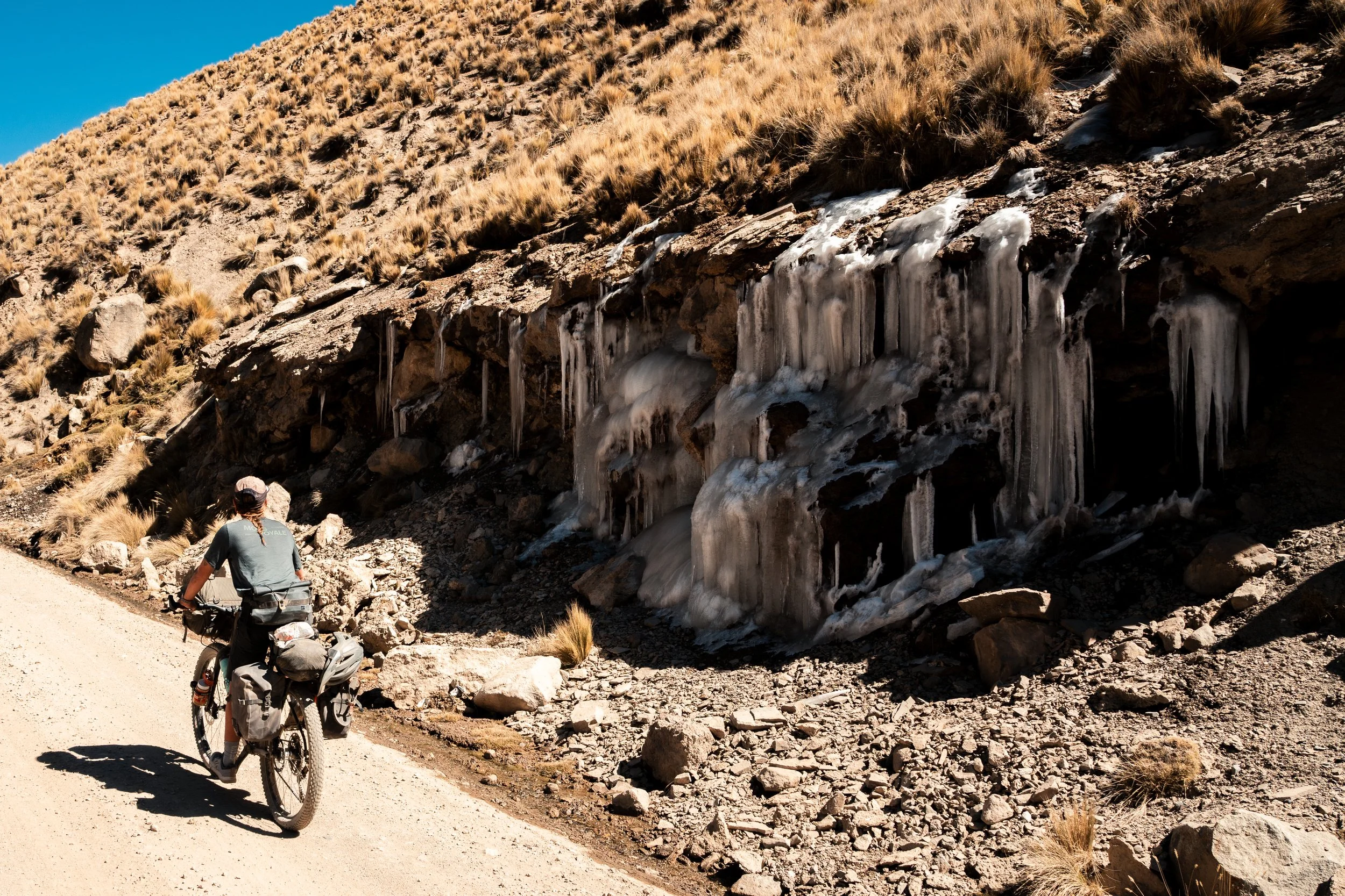
Beyond the pass the road undulated around the flanks of Illimani, an old mining road, dropping away to our left in a series of valleys far below us. The scenery was amazing, and the riding was fun. We passed a series of frozen waterfalls, before coming to a much more significant one. Rather than small frozen puddles on the road, this was a twenty metre stretch of layered ice. Off-camber, it poured over the edge of the road, into a 30m cliff. I sent Lauren over first, as the lighter one, and I followed. Lauren made it seem easy, as she steadily crossed, but I didn’t have the luck. My bike continually slid away from me, and I slid myself trying to keep it going over the edge.


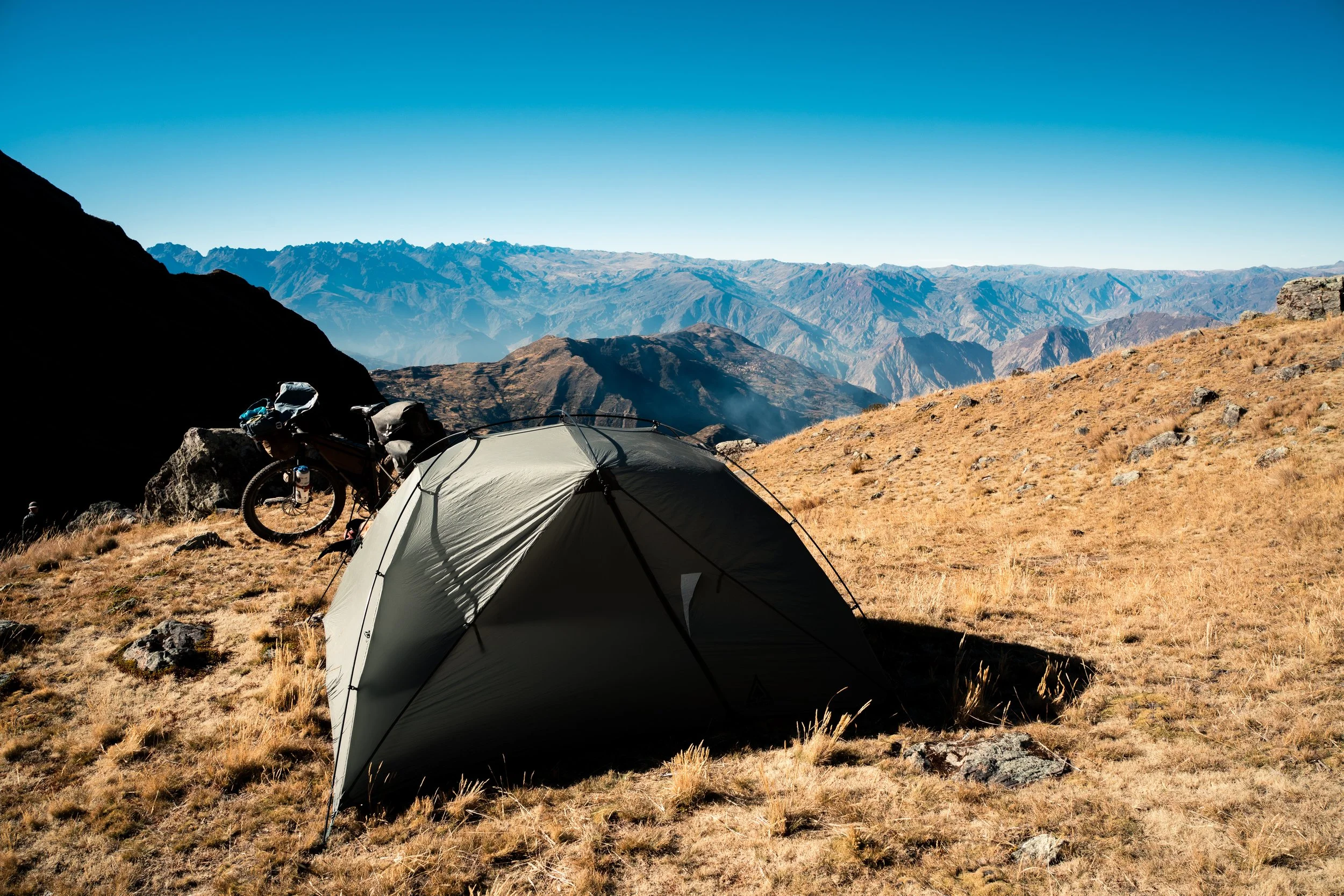
Just beyond we came to a large open field, with a tent and toilet - this was the base camp for climbing Illimani it seemed. We had only gone 13km, but it was already 3pm, so we decided to stop early for the day. The broken sleep, broken equipment, and forgotten items told us it was not our day. Illimani was completely clear of cloud, and had been since we first saw it; a rarity it seems, as it was always clouded in when we were first in La Paz. We were relaxing in the sun when a man with a dog arrived, and asked for food. Only having the barest supplies to make it to La Paz, we didn’t have anything to spare, but gave him half a bag of coca leaves. We usually carried these, but had only used them about three times in the course of our journey. It was a cold, windy night, as the air made its way through the hole in the tent.

Frozen roads
The next day started with more undulating around Illimani on the mining road, but here it was a double track, rather than the broken rocky road beyond the frozen waterfall. The road was scattered with ice puddles, areas in the shade never thawing out. We descended a few hundred metres, rode up a valley, and then climbed a few hundred more before cresting around a ridge, and joining Abra Pacuani. This was the pass that marked the top of our climb out of the Yungus, our first ride in Bolivia over two months previously. We had considered riding straight into Mama Coca at the time, which would have been a huge mistake.


Traffic jams.
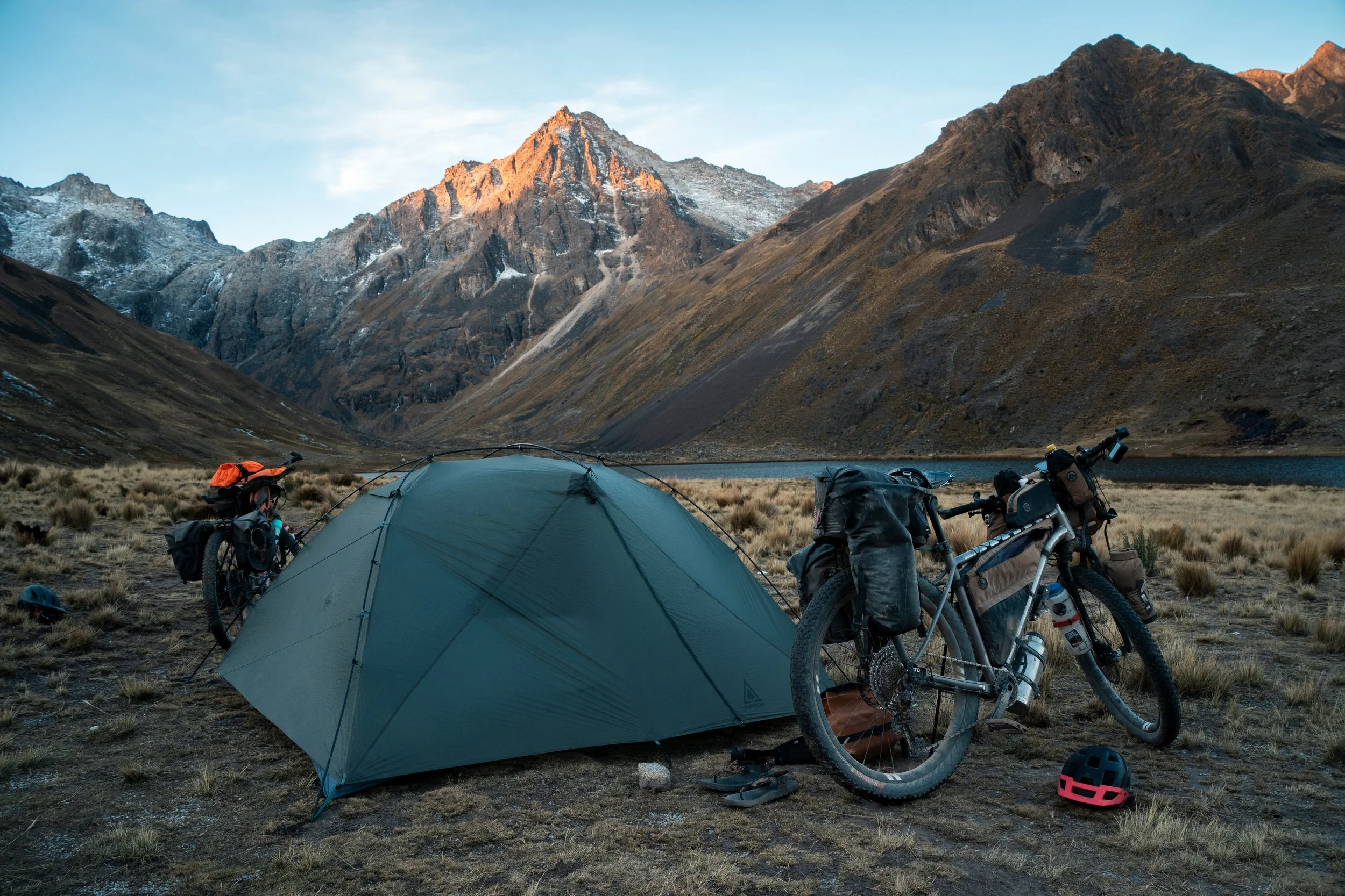
We descended on the same terrible road as the first time, taking 90minutes to go 20km whilst losing over 1000m in elevation. The biggest difference was the lack of traffic; we only saw a couple of hiluxes, when previously there was a steady stream of trucks. Rather than take the same route back to La Paz, we planned to head up a side valley and take a hike a bike over a pass. Starving, we were ecstatic to find a good tienda and restaurant at the turnoff, and we supplied with snacks and ate plenty. We climbed a steady 7km into the valley, before turning onto a double track at the village, and climbing into a hanging valley. There was a lake 4km up the track we hoped to camp at, and after pushing up multiple steep sections, we made it with just enough time to get the tent up before dark.

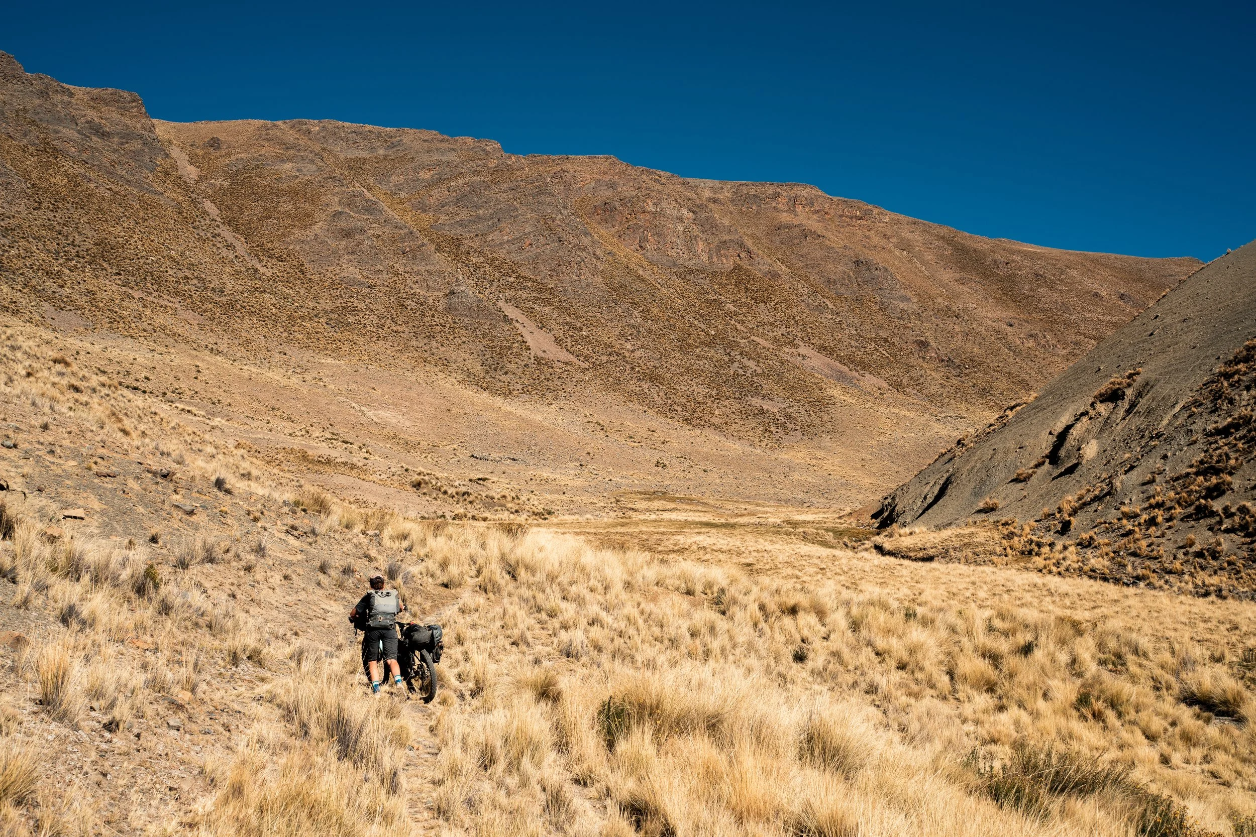
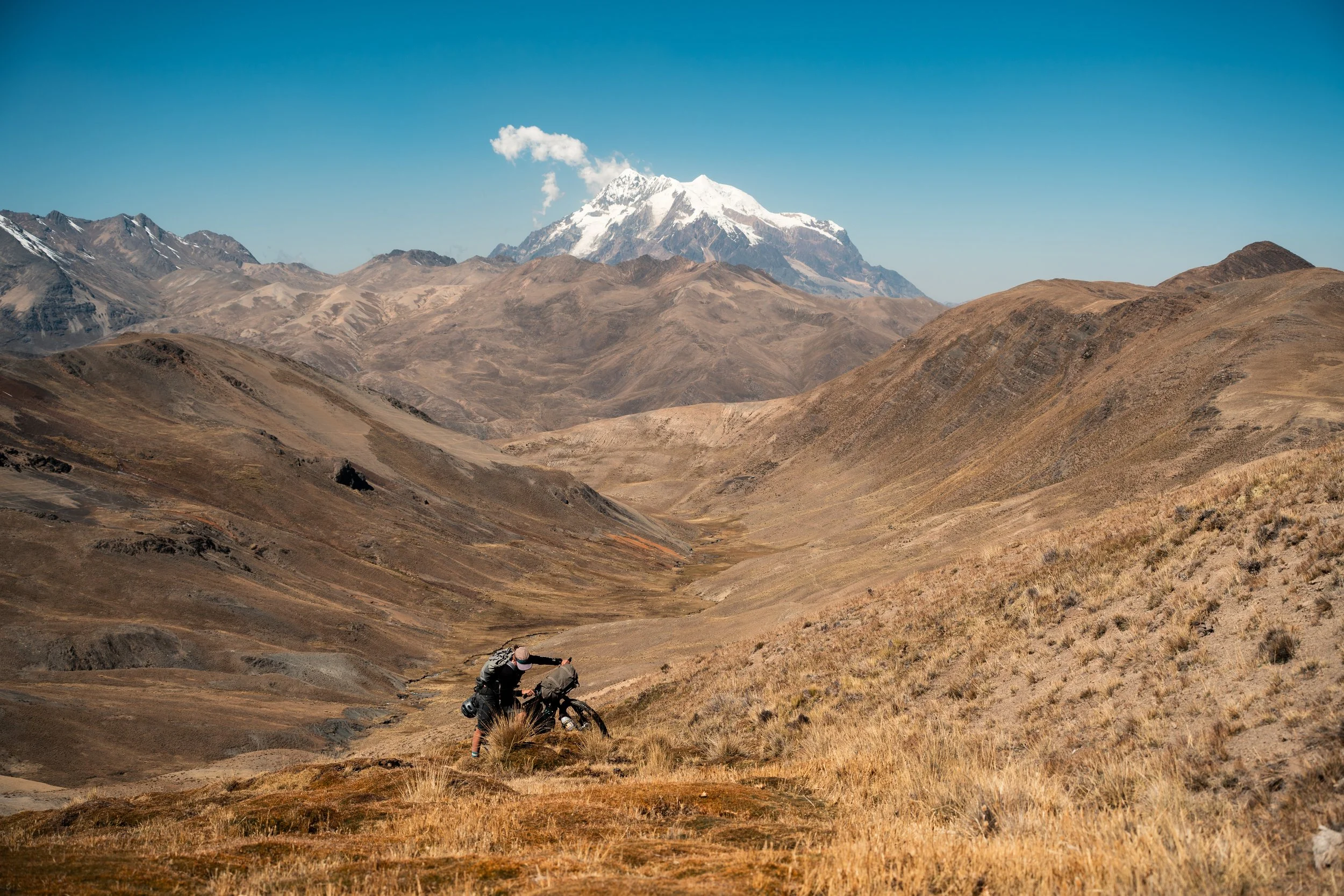
This next section was our first real hike a bike of the trip, 5km up a valley and over a 4900m pass. We loaded our backpacks to relieve weight on the bikes, and set off, pushing up a steep gully on a llama track, before it flattened out and we pushed across open fields full of llamas, cows, and a few horses. Looking ahead, there seemed no way we would be able to take our bikes over the sheer sided walls at the head, and Lauren didn’t believe me when I pointed out where we were meant to be heading.

Our campsite is in the background.

The pass is at the far left of the image on the ridgeline.
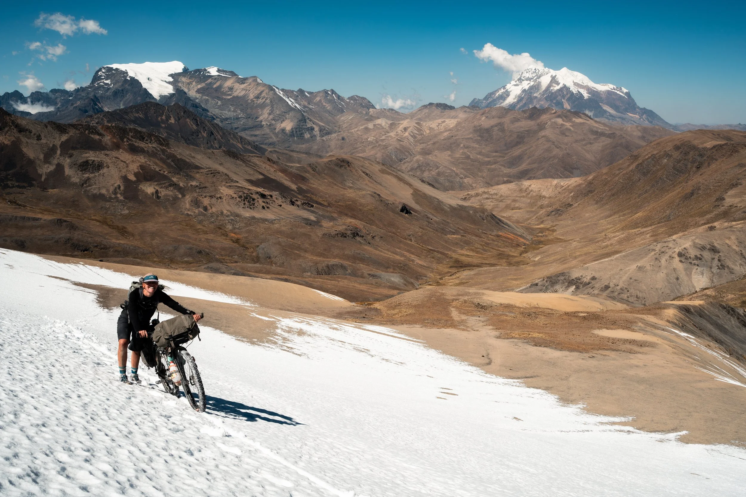
There wasn’t much of a track to speak of, so we followed the GPS track as we wound up the side of the valley and around the bowl at the head of it. It was slow going, crossing streams (mostly frozen), marshy ground, and up sheer gradients. A few steps forward, then breathe and check the map. We took it one step at a time, climbing slowly but surely. Near the top we crossed a sheer scree slope, before realising the last section was directly up a patch of snow. It wasn’t deep, but wearing mountain biking flat shoes and pushing bikes, it took a lot of effort. Two steps, plant the feet, push the bike, steady yourself and the bike, take a breather, repeat. The wind came up, and nearly blew Lauren over.

The valley seemed a long way below.

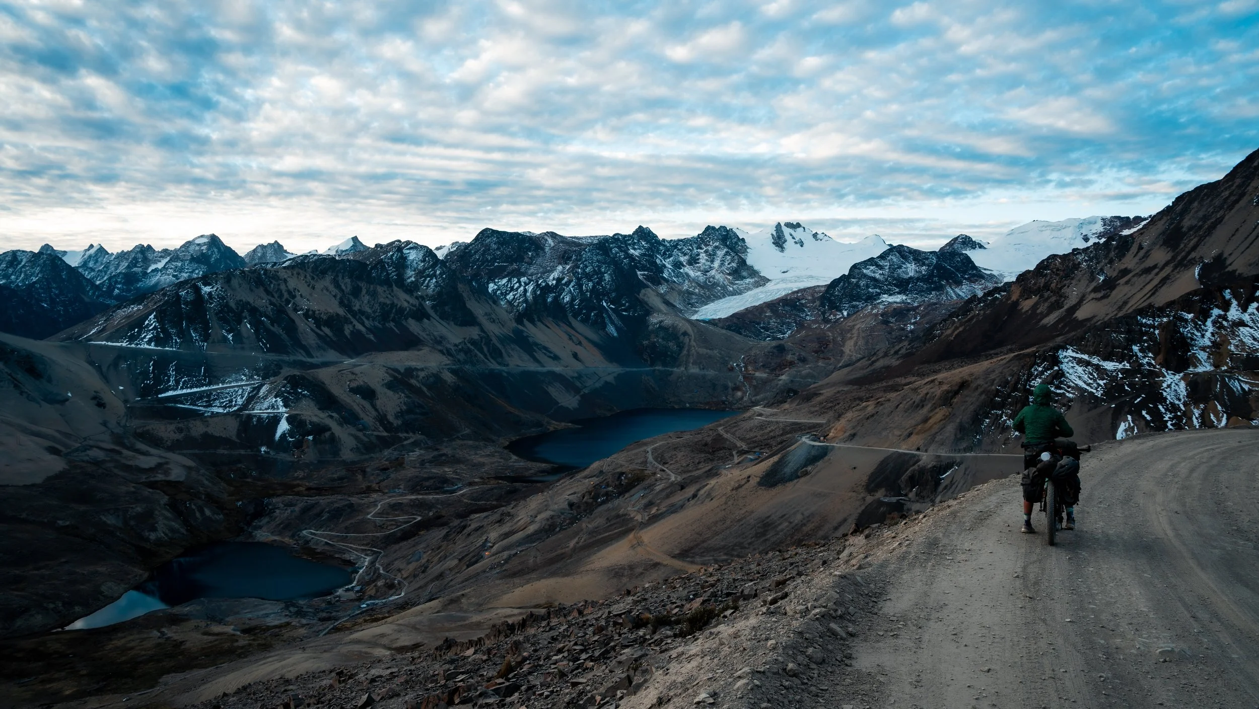
Four and a half hours after setting off we reached the top. We simultaneously had a massive sense of accomplishment, and a sense of WTF, as we stared down a near vertical scree slope we were supposed to get down on the other side. One thing we don’t have is a GPS locator or rescue beacon. Scoping around in the howling wind, I saw a track, we just had to scrabble down some steep rock, and then traverse the scree. It looked worse than it was, and we were shortly on the valley floor. From here we enjoyed a mix of single track riding and pushing, until we joined a downhill road that would take us all the way to the centre of La Paz.

View from the top.


Starving as we entered town, we had the option of climbing 400m over a ridge, and trying to navigate through the city, or continuing a further 10km downstream to the bottom of the city and catching a series of telefericos. We opted for the latter, and after lining up three times for tickets (they continually sold us the wrong number for us and the bikes), we got to enjoy a quiet, scenic view of the city we last saw nearly two months prior, and which had been rocked by protests and food shortages in the interim. It turned out the hostel (we used previously) had only reopened the same day we arrived as they had closed for two weeks. The city had run out of chicken, eggs, and basic foodstuffs, and dynamite had gone off every few minutes in the streets surrounding. It seemed to be back to normal now though, and we went to our typical pizza place to ingest as many calories as possible.