Ruta de Las Vicuñas
Riding alongside the Salar de Surire
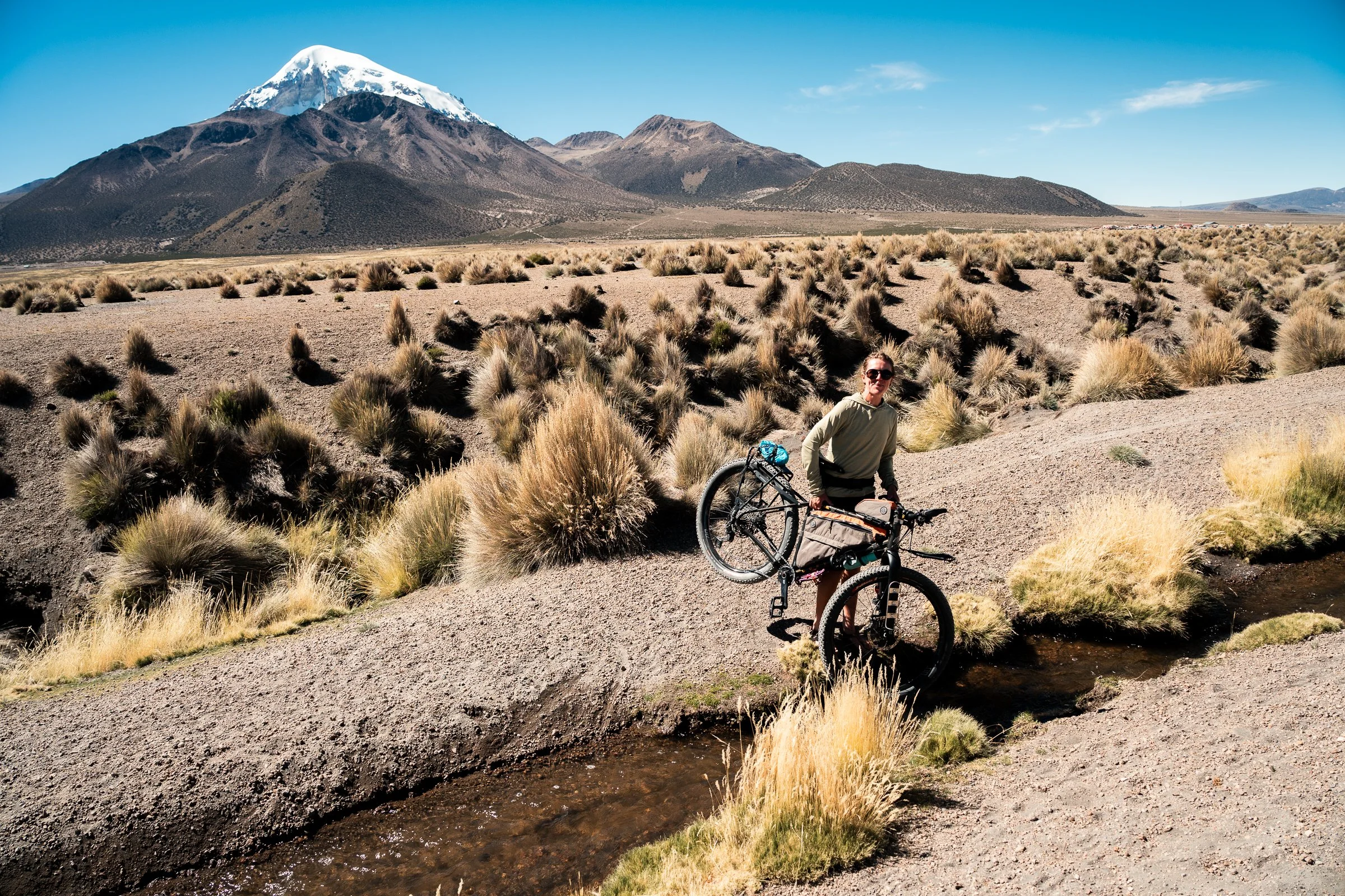
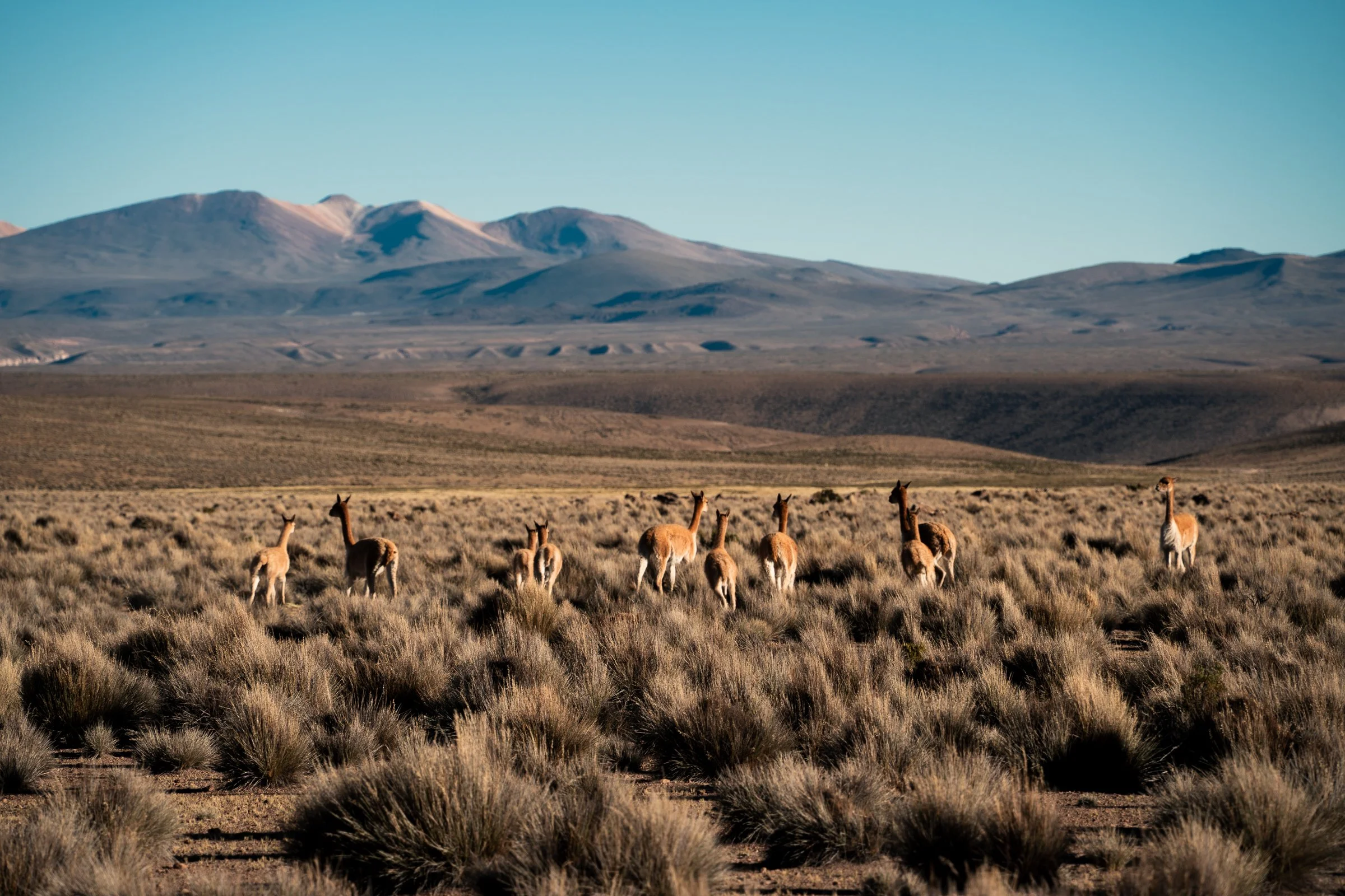
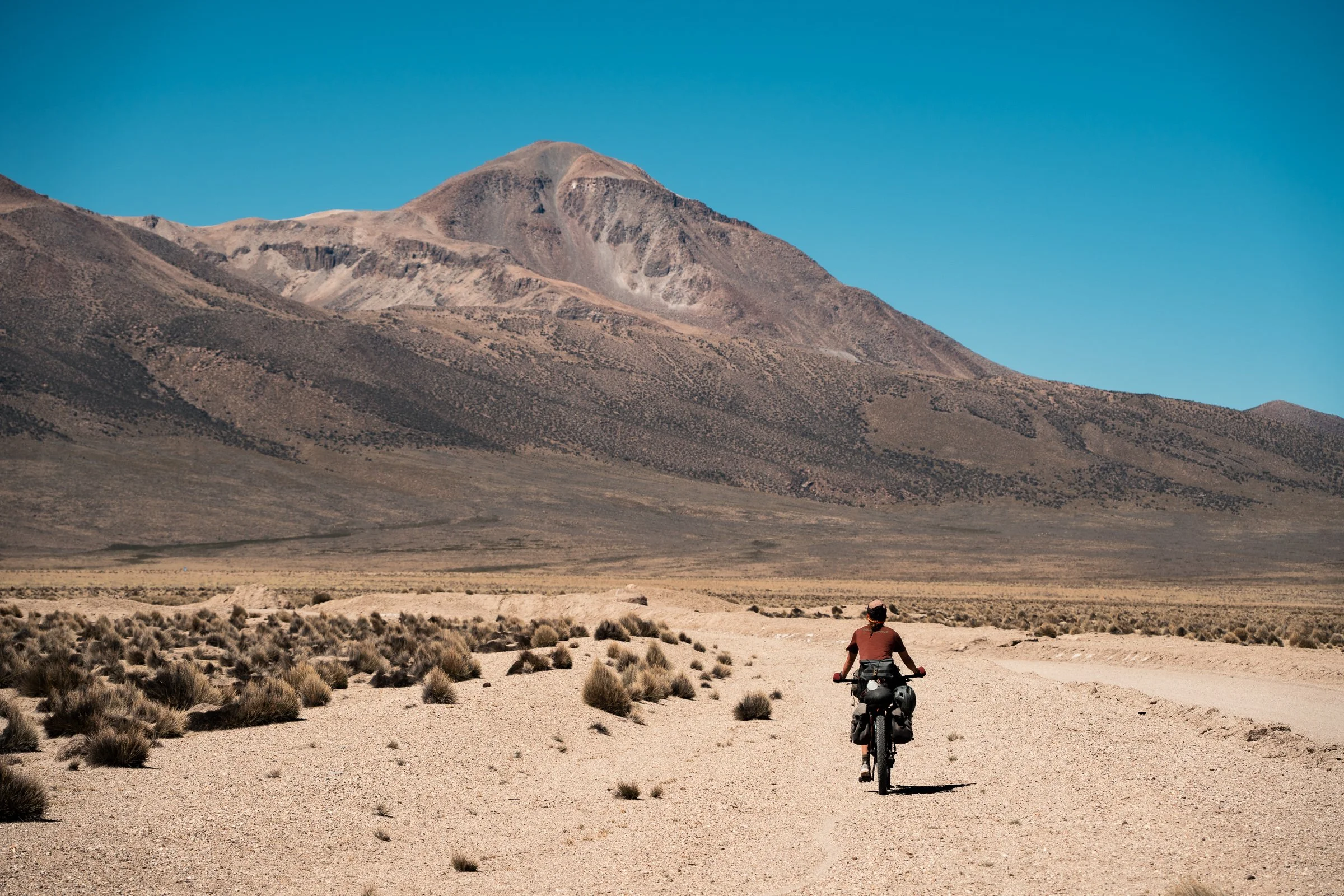
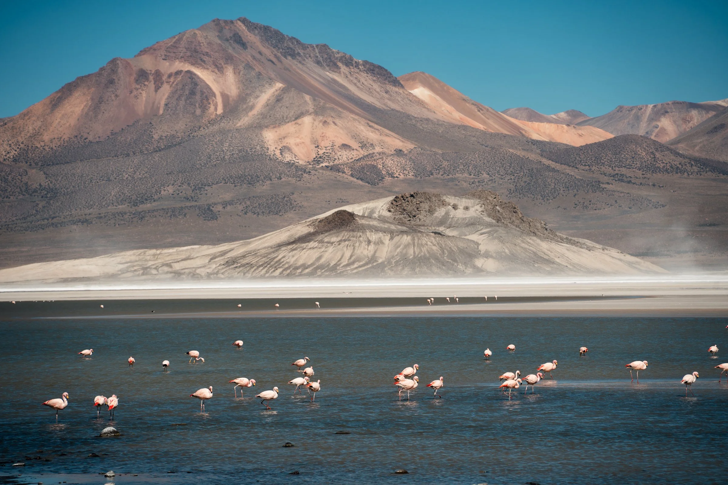
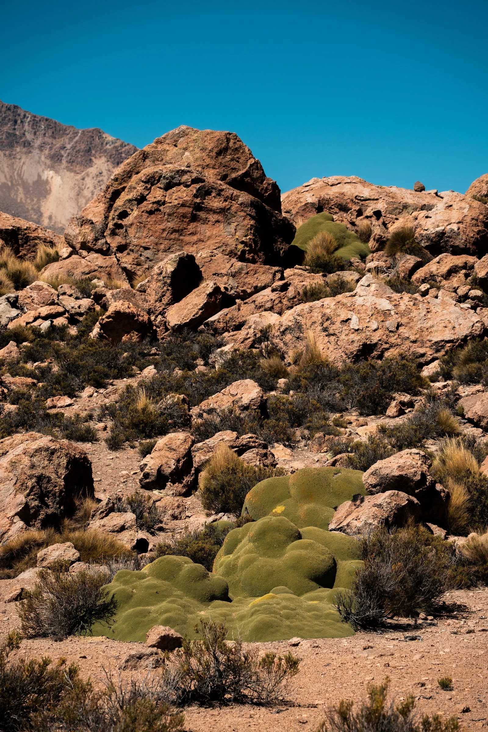
After recovering for 2 nights in Sajama, giving our bikes some much needed maintenance and eating everything we could get our hands on, we hit out for the Ruta de Las Vicuñas in northern Chile. This would take us through the Lauca and Vulcan Isluga national parks, as well as the Vicuñas national reserve and Salar de Surire. The vicuña is the wild relative of the llamas universally tan brown, they are more lightly built and agile appearing than their domesticated cousins.
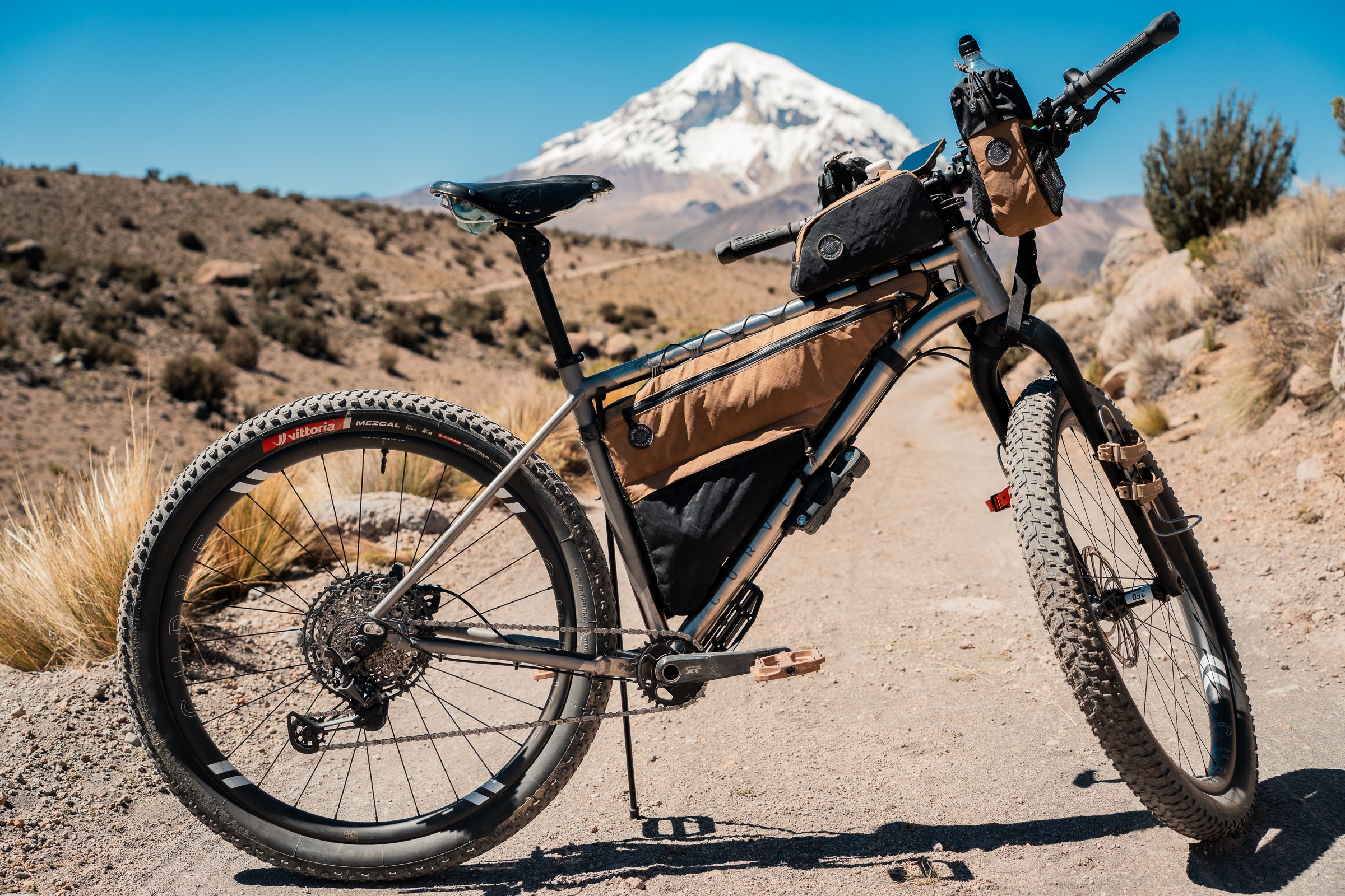
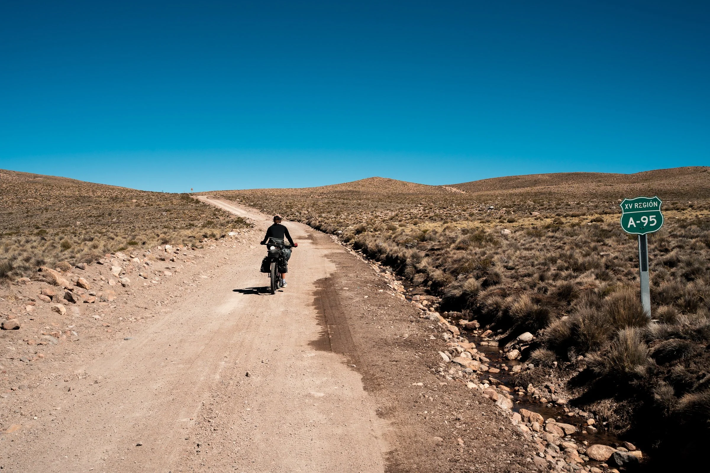
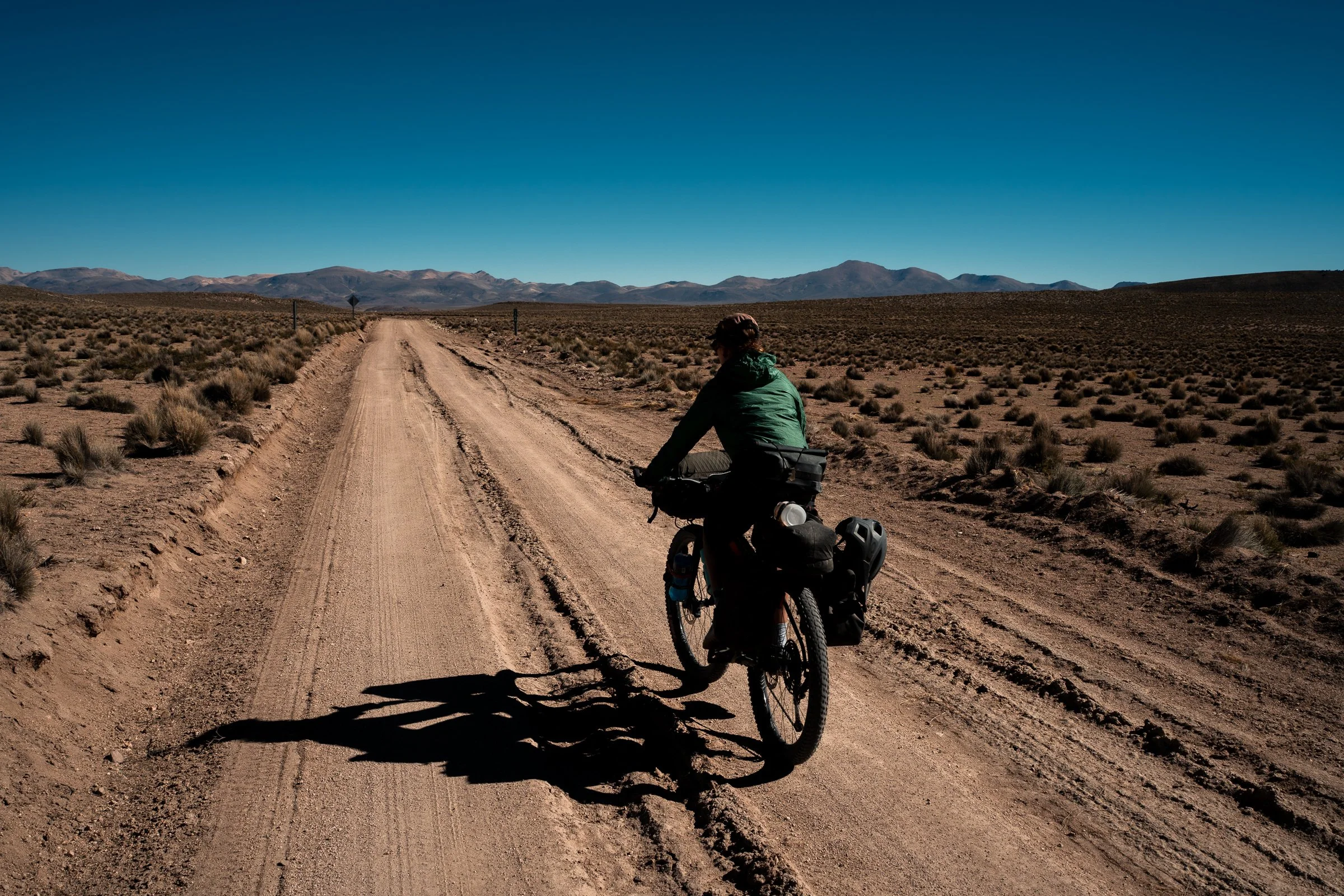
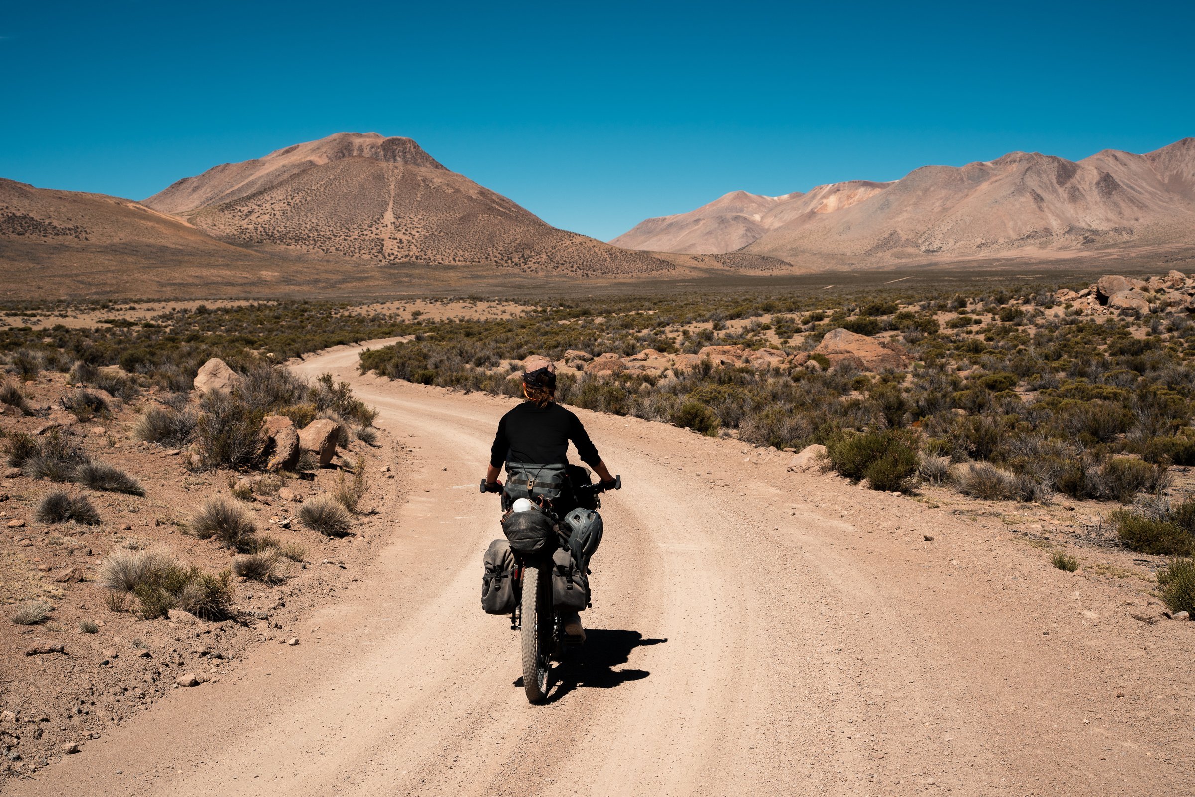
There are no shops or supply points on this route, so we were entirely self-sufficient, carrying copious amounts of instant noodles and chocolate bars. We had a quick overnight stop in the border town of Tambo Quemado, where they wouldn’t let us order a second serving of breakfast, forcing us to another shop for the second round. After huffing and puffing our way to the border at 4680m elevation, we were in Chile.
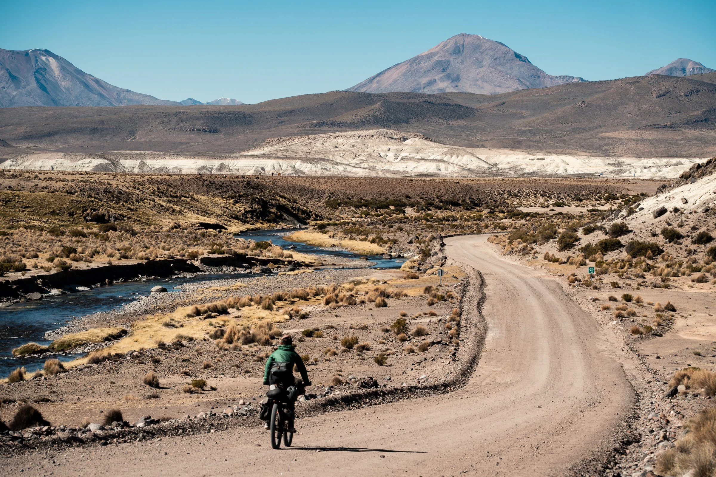
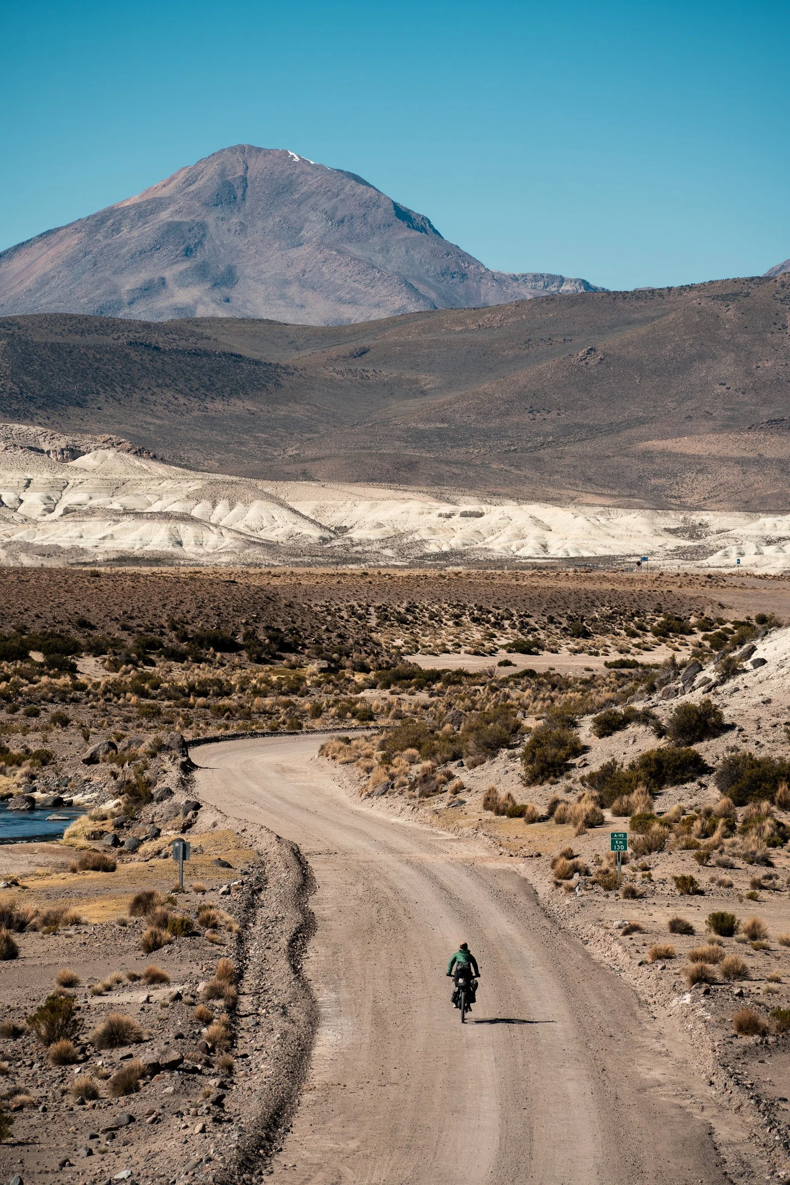
We had hoped to exchange some currency and get sim cards at the town nearest the border, but it proved to be a derelict truck inspection point, the only living souls being a flock of flamingos and vicuñas on all sides. We turned off the smooth tarmac highway onto our route, and were immediately welcomed by the sandy corrugations that would be our riding surface for the next 4 days. The first task was to climb over a 4700m pass (the high point of our trip so far), winding up a broad boggy valley full of llamas and vicuñas. At the top were a couple of smashed and abandoned cars, we assumed as the result of the smuggling we had heard occurs through this region. Cresting the pass, we gently wound down, past the Churiguaya hotpools, before undulating along a Ridgeline in the bottom of the valley. Llamas and vicunas were still seen constantly, grazing. Our target for the day was the small village of Guallatire, which had rumours of a potential hot meal. About 10km before this, I started to flag. On the altiplano there are very few shops, and we had only found a handful since leaving La Paz 6 days prior. Getting enough calories in to sustain riding day in and day out is a struggle, and I would typically run out of steam in the afternoons, as the oats and instant noodles weren’t enough to keep me going. I popped a few gummy teeth in my mouth, and they just managed to get me the rest of the way.
On arriving to Guallatire, it was even smaller than expected. There were two policemen at the entrance who waved at us, but other than that we didn’t see anybody. We stopped and wandered the village amongst the roofless buildings, but the CONAF office and reported accomodation were locked shut, and looked as if they had been for some time. Deciding it was getting too late to push on, we pitched the tent in a llama pen on the outskirts of town to protect from the winds.
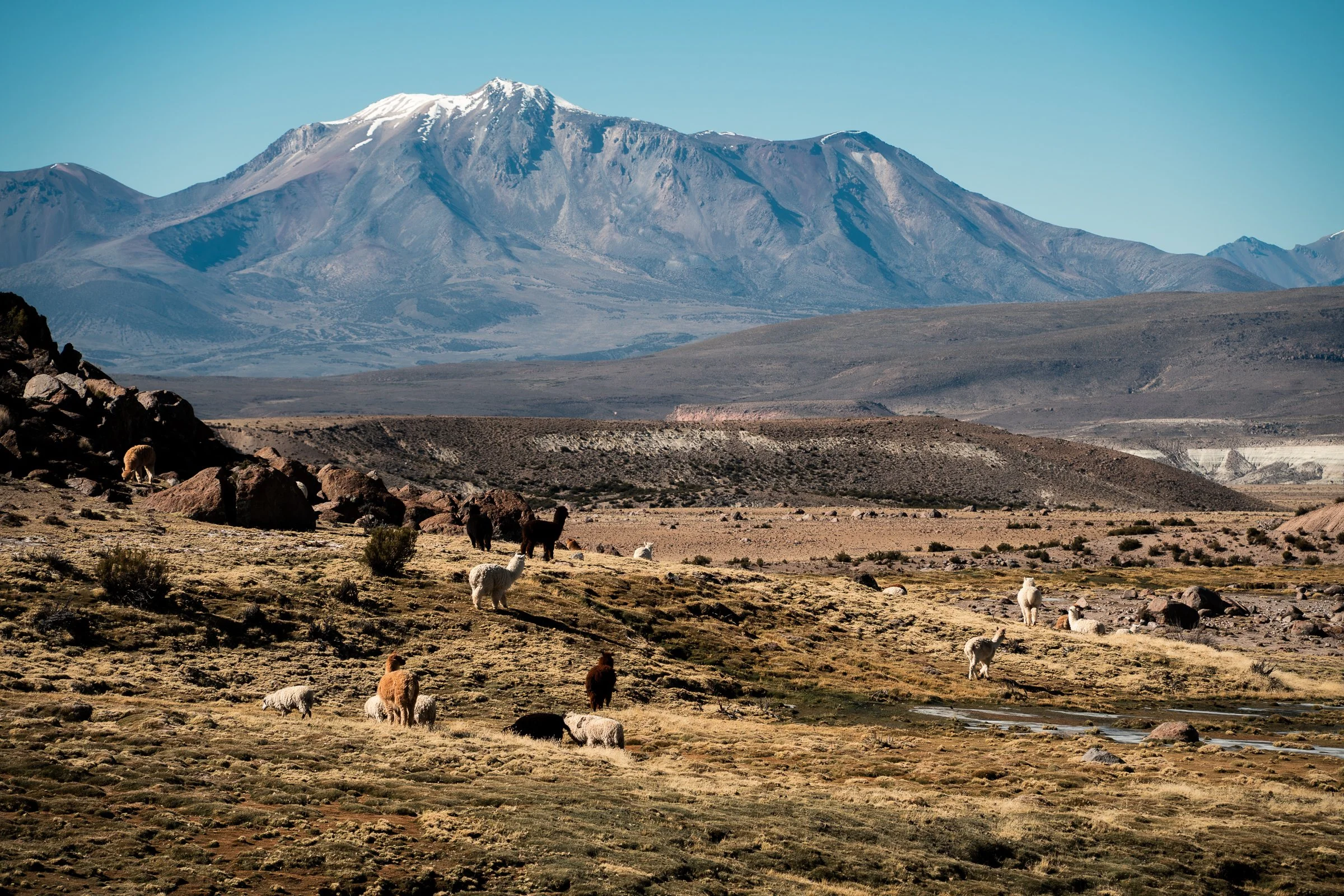
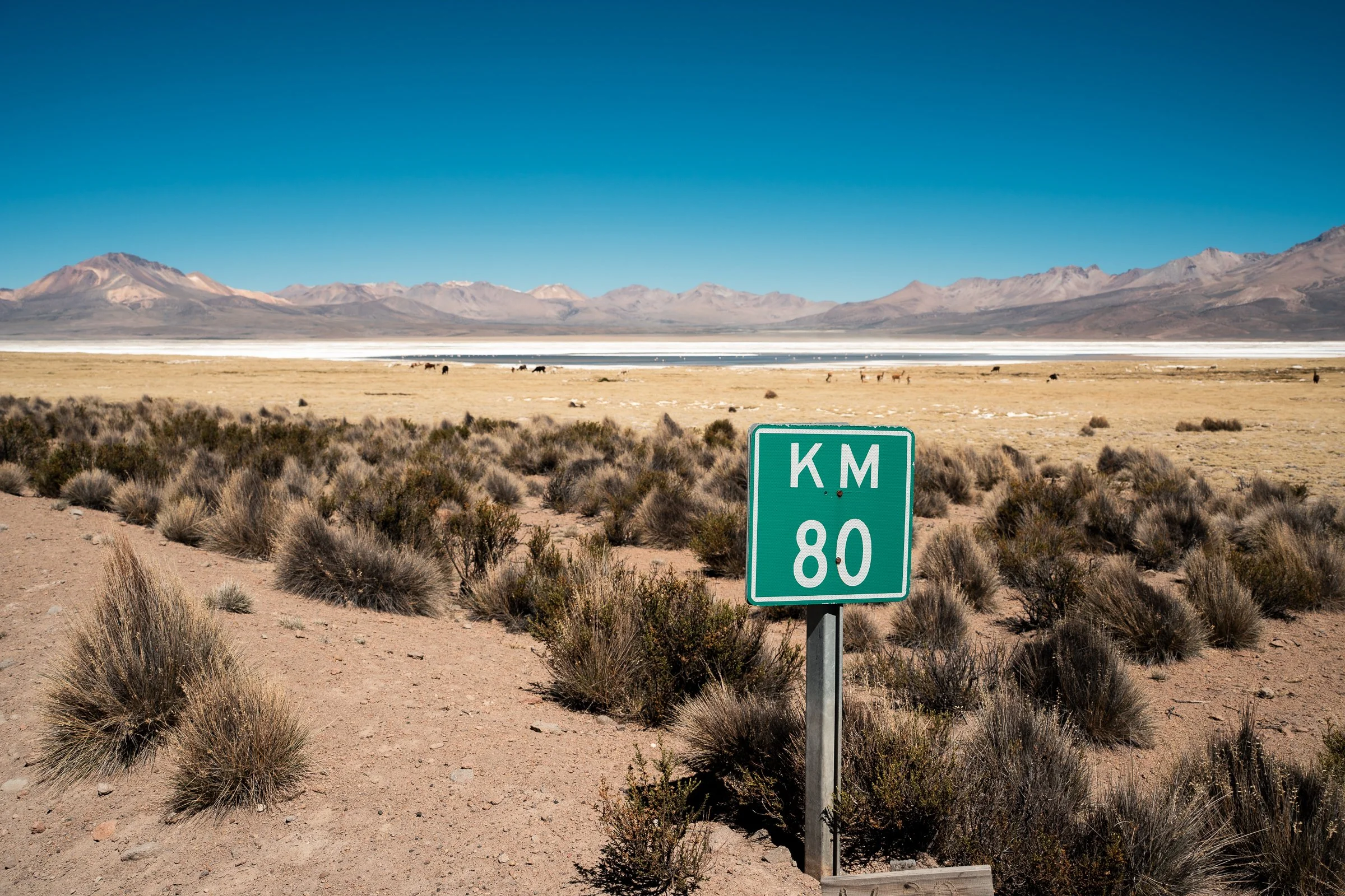
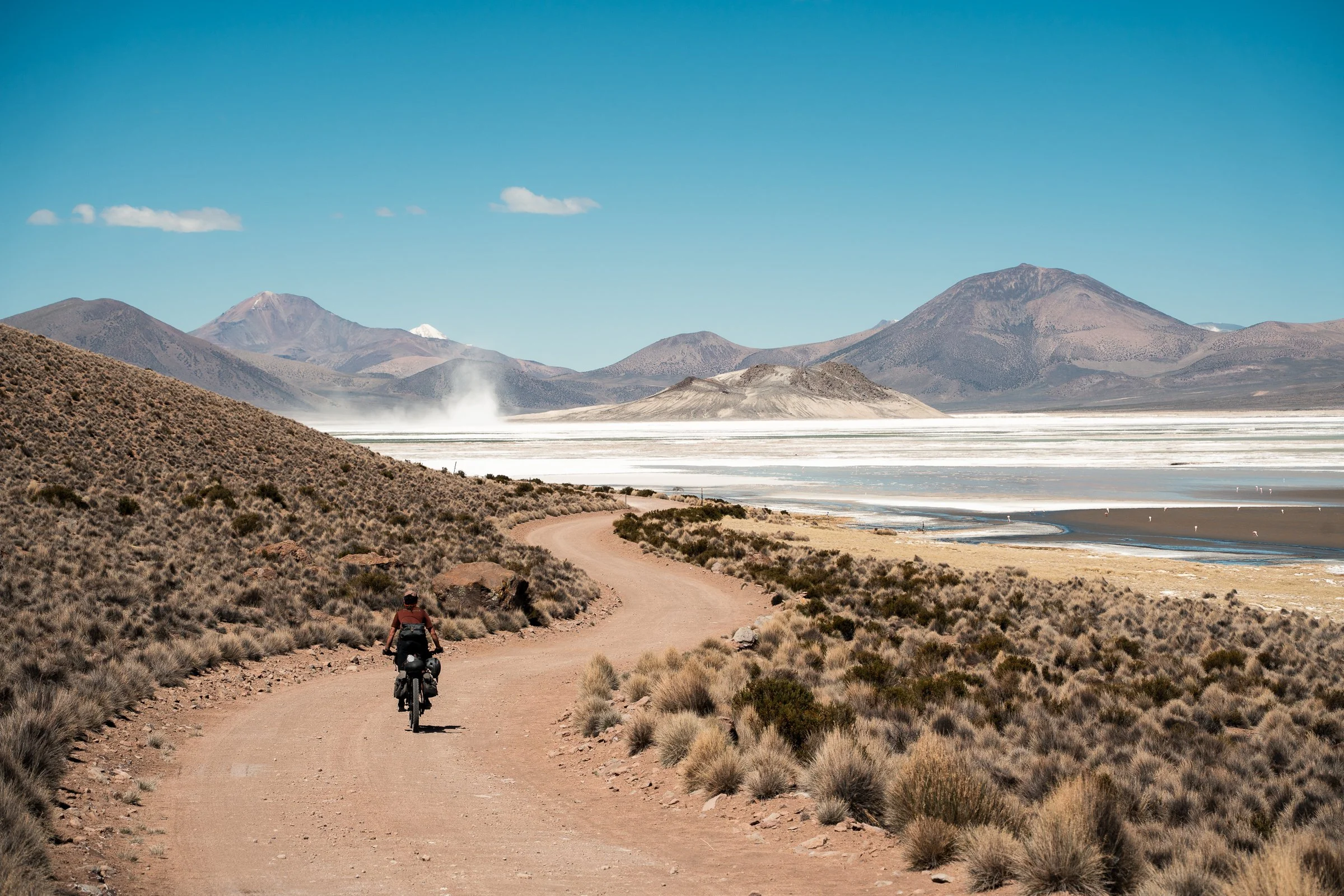
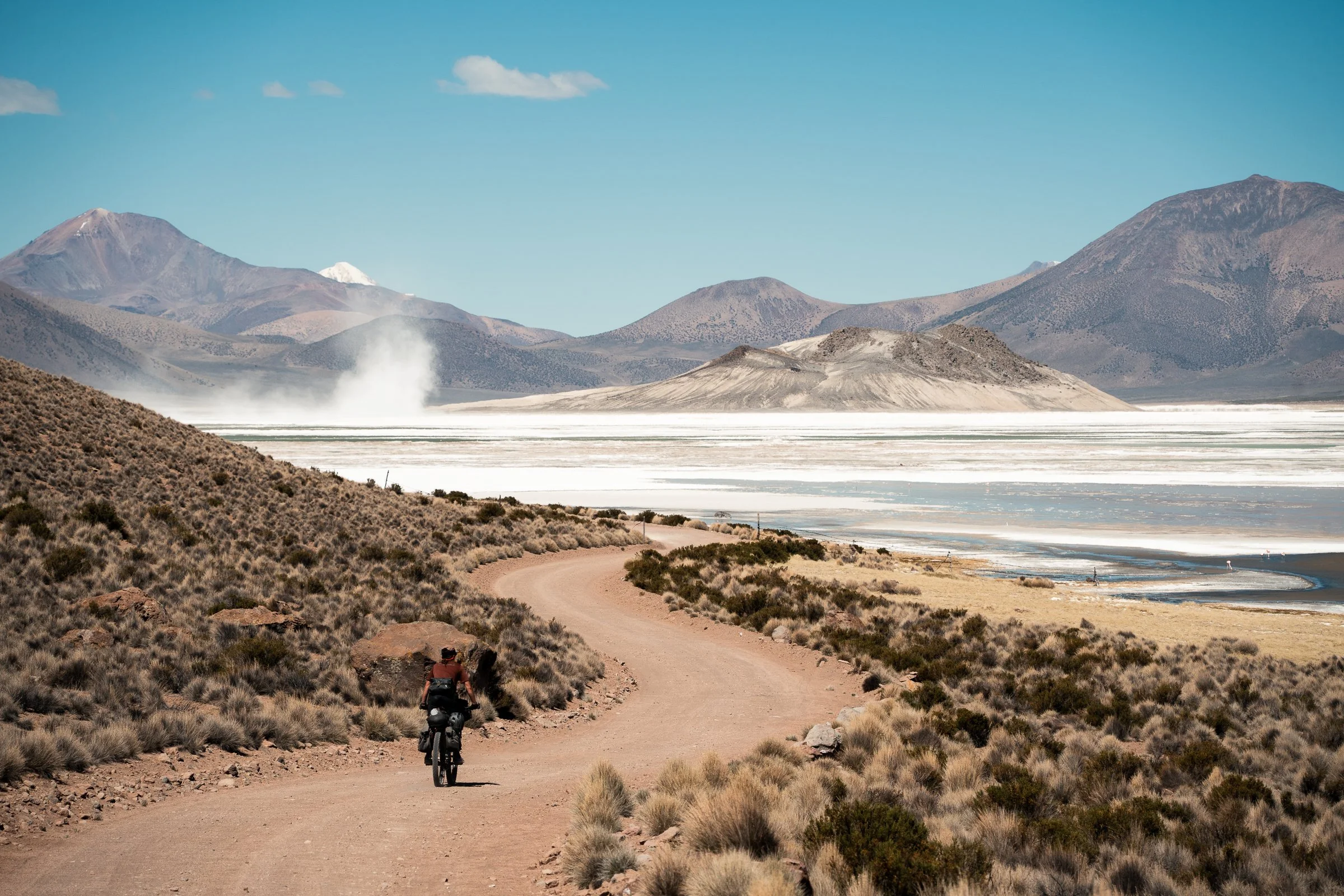
Morning brought another frost covered tent, but no further signs of life in the village, so we filled up our water from a tap in town, and headed out. The first few kilometres were amazingly beautiful, as llamas herded in a grassy valley floor, with a still mostly frozen stream running through it. After this, we crossed a broad plain and then began climbing to the Salar de Surire. The salar is not entirely salt, and there were plenty of pools of water full of flamingos, and the now familiar vicuñas and llamas grazed by the sides. We waved to a couple of policemen guarding the entry road, and began the near-complete circumnavigation of the salar we required to get to the hot pools we hoped to camp at that evening.
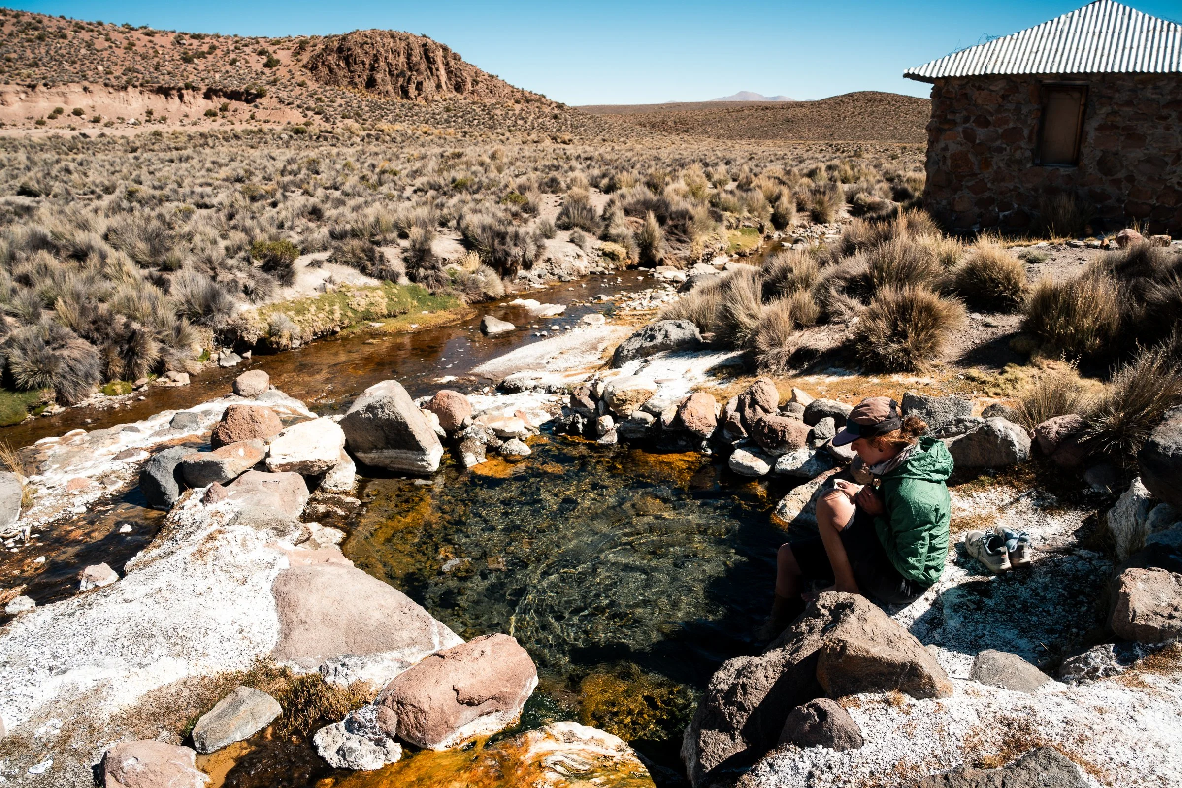
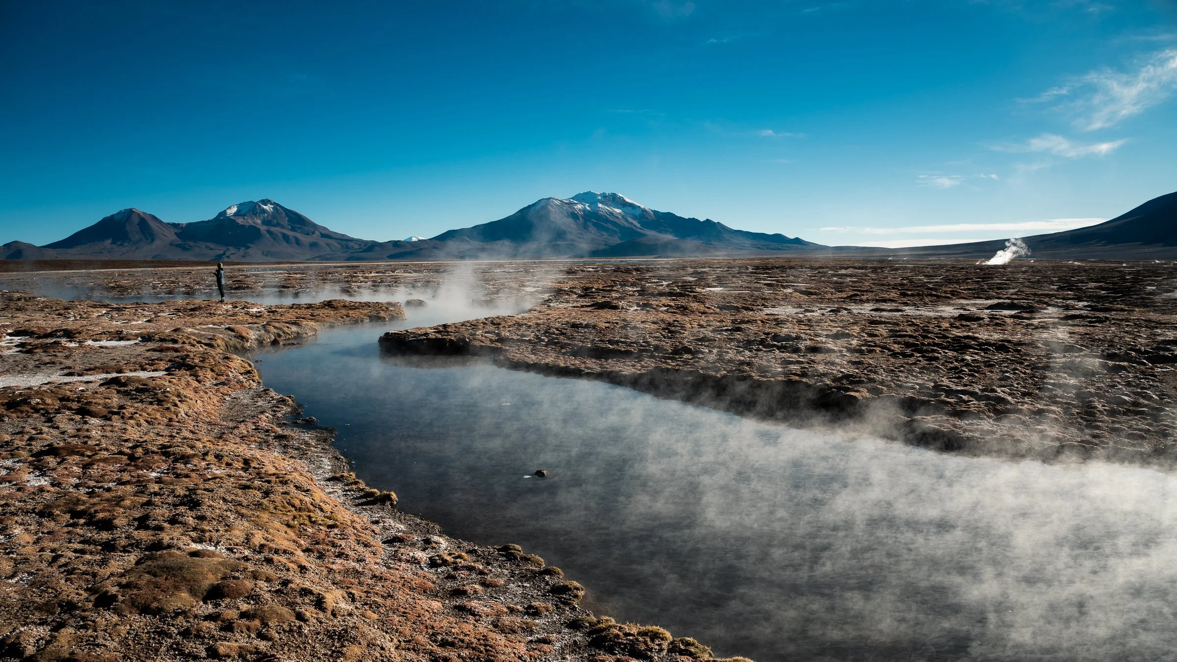
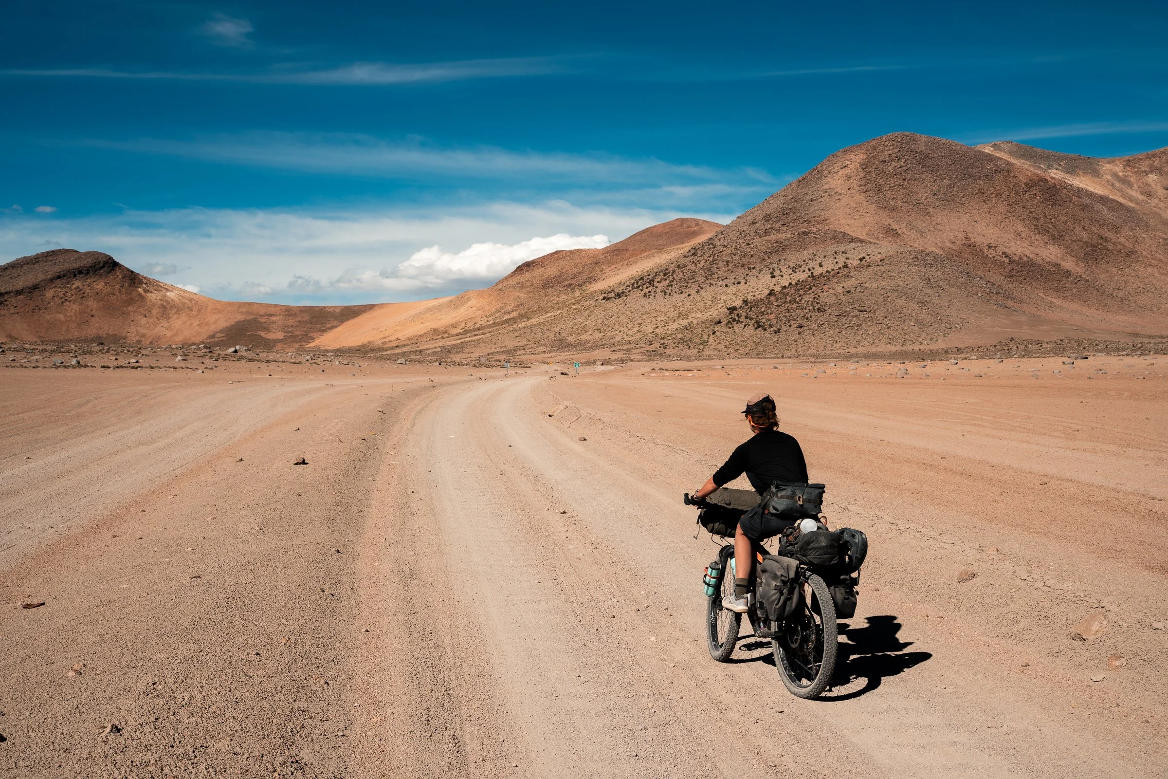
The road was soft, sandy, and unrelentingly corrugated, as we zig zagged across it trying to find the smoothest surface to cycle on. The winds picked up again, making our lunch of soup nearly a non-goer as we couldn’t get the alcohol stove to stay lit. We managed some warm broth (the rice was decidedly raw), as we watched the flamingos nearby. There are three kinds of flamingos here, the Chilean, the Andean, and the James. We think it was the Chilean we were looking at, based on the information board in front of us. The wind picked up again, and it was into a headwind we finished our days riding. Not long before sunset the pools came into view, steaming in the distance. We struggled to get the tent up in the freezing wind and firm ground, anchoring it to a picnic bench to stop it blowing away. We braved a dip in the pool before bed, but in the dark and with a below freezing wind it was somewhat less than relaxing, especially after the wind blew my towel into the water, soaking it.
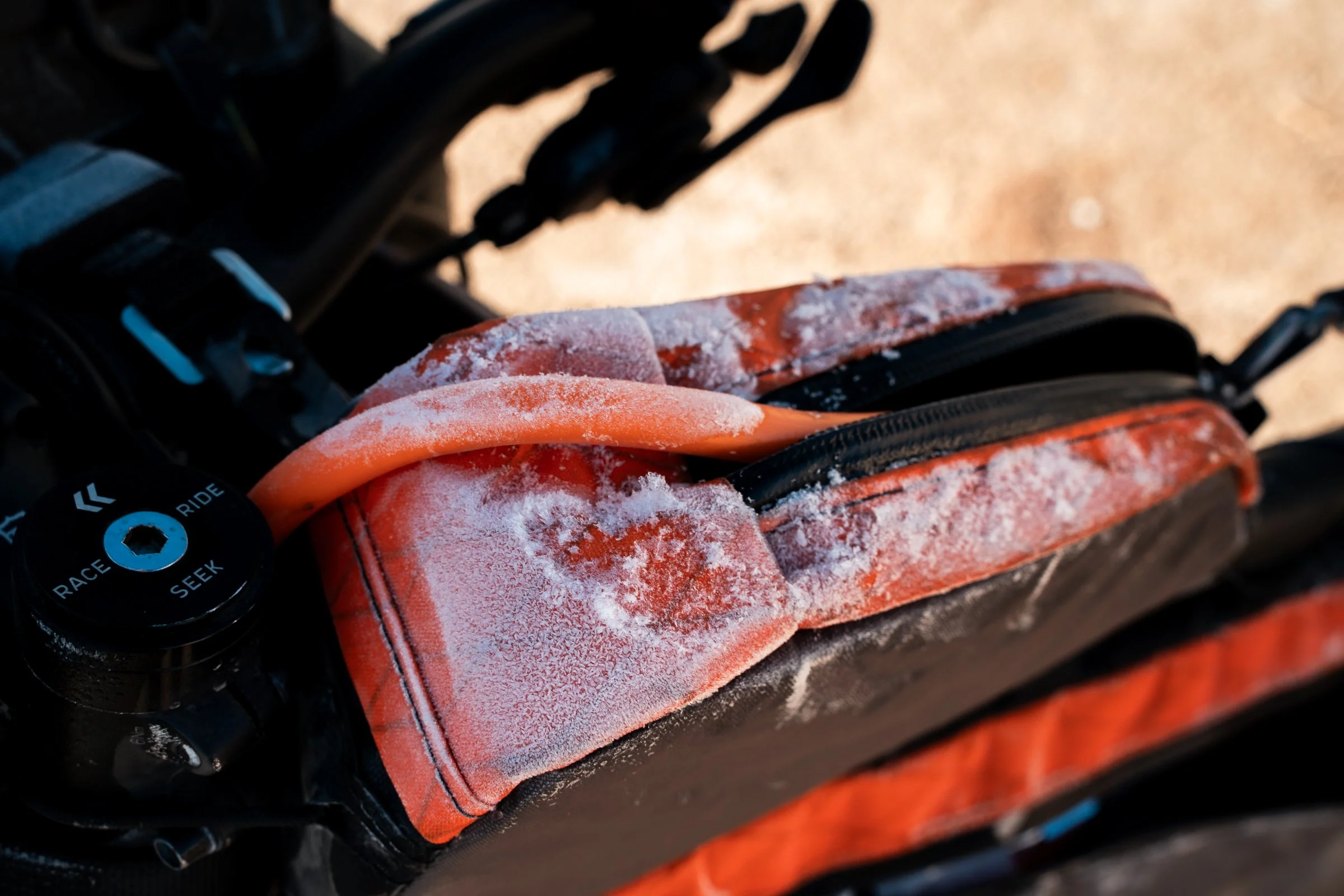
We opened the tent in the morning to see a flamingo lazily strolling through the pools a few metres away from us. With the steam rising off the pools, it made yesterdays struggle worthwhile. We gave ourselves a lazy morning to thaw, necessary as the steam from the pools had caused all our belongings to be covered in a film of ice. The perfect reason for another dip, much more relaxing with the sun shining, as they were perfect bathing temperature.
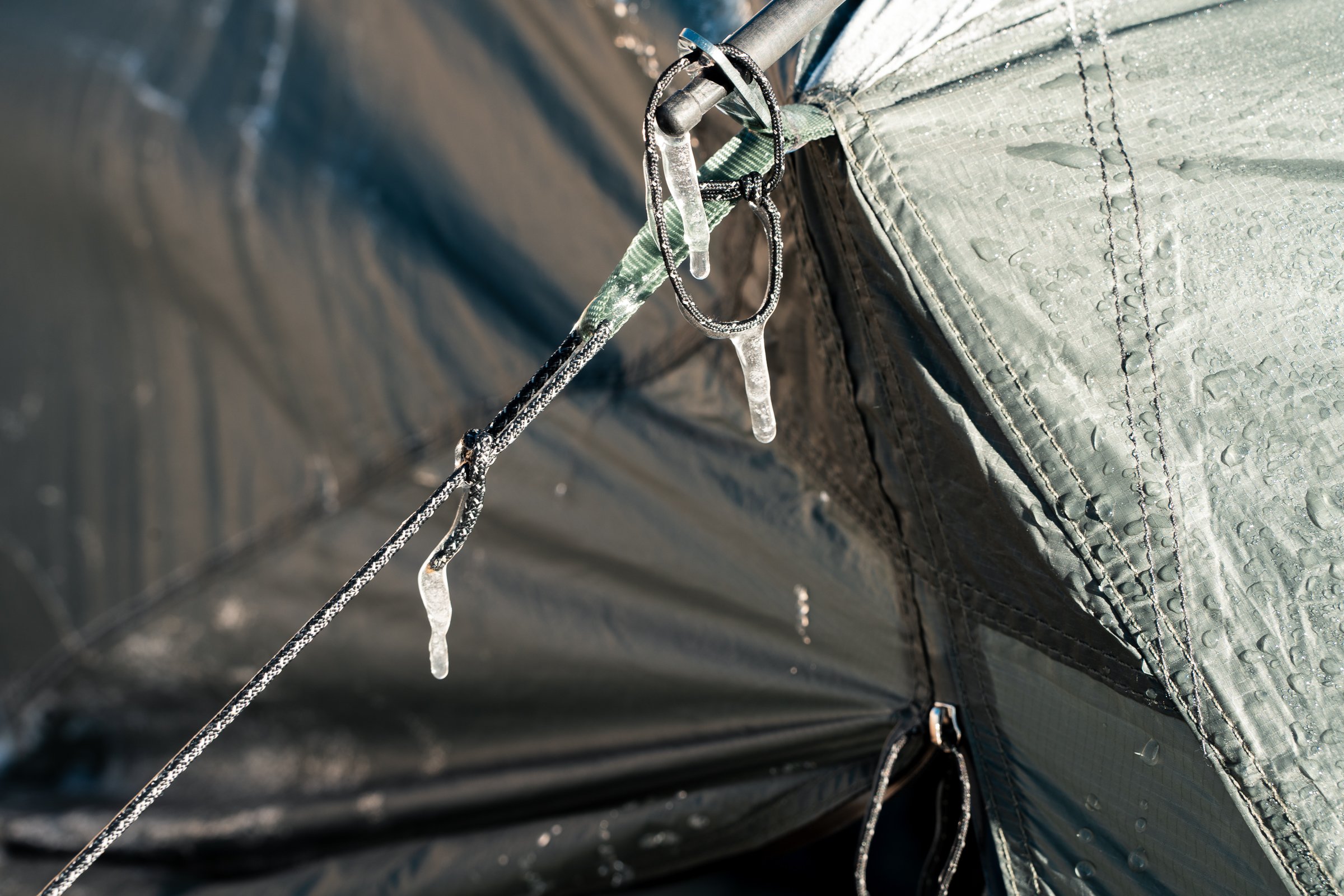
Besides the persistent caloric deficit we were operating in and the altitude, another great challenge of this trip so far was the weather. Winter is the dry season, and riding season. This brings cold (-10ºc or so) nights, but generally warm (10-20ºc) days. Unfortunately the sun sets about 6pm, and the cold really sets in from about 5pm. By the time the sun has risen and defrosted the tent, it makes for short ridings days (about 9am-5pm), and the rest of the time spent huddled in the tent wrapped up in all our layers, dreaming of calorie-rich dinners.
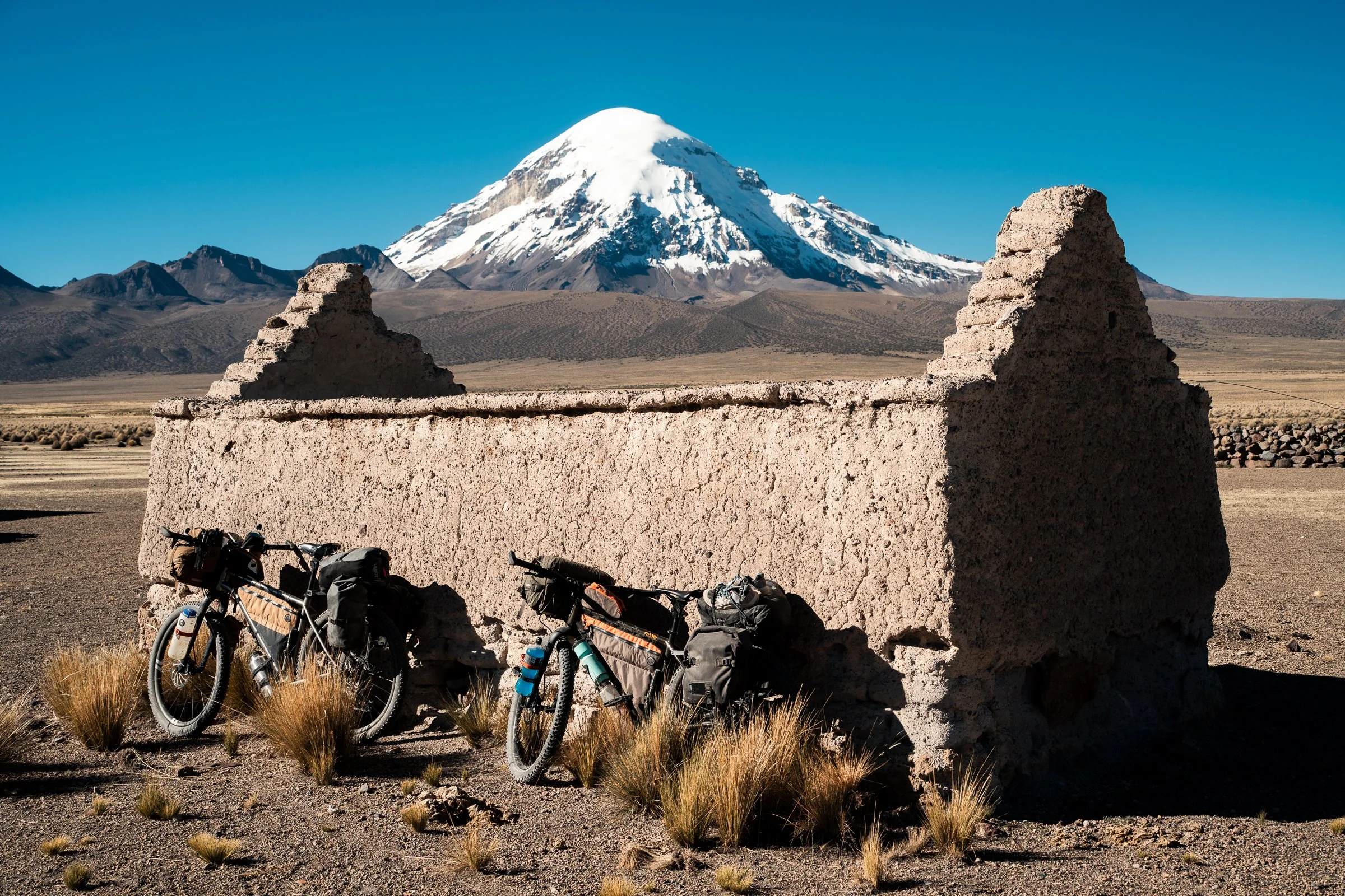
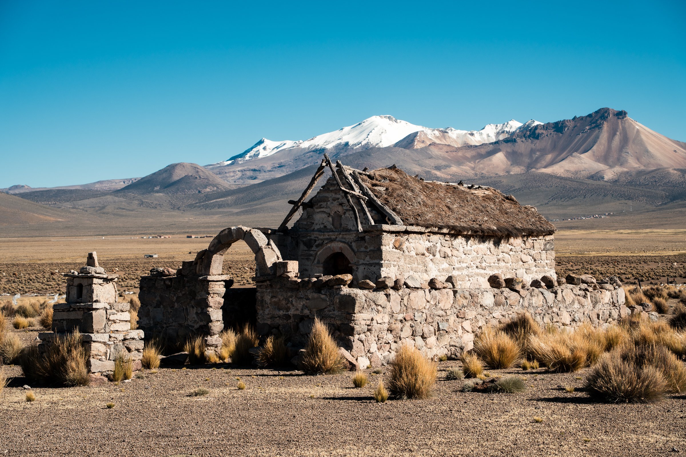
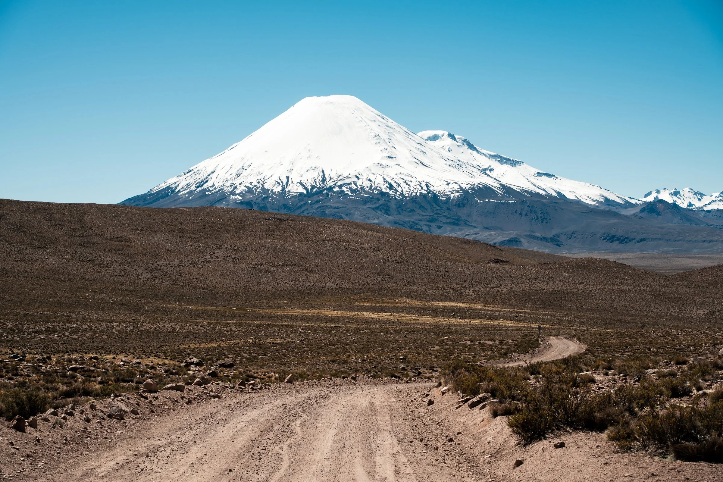
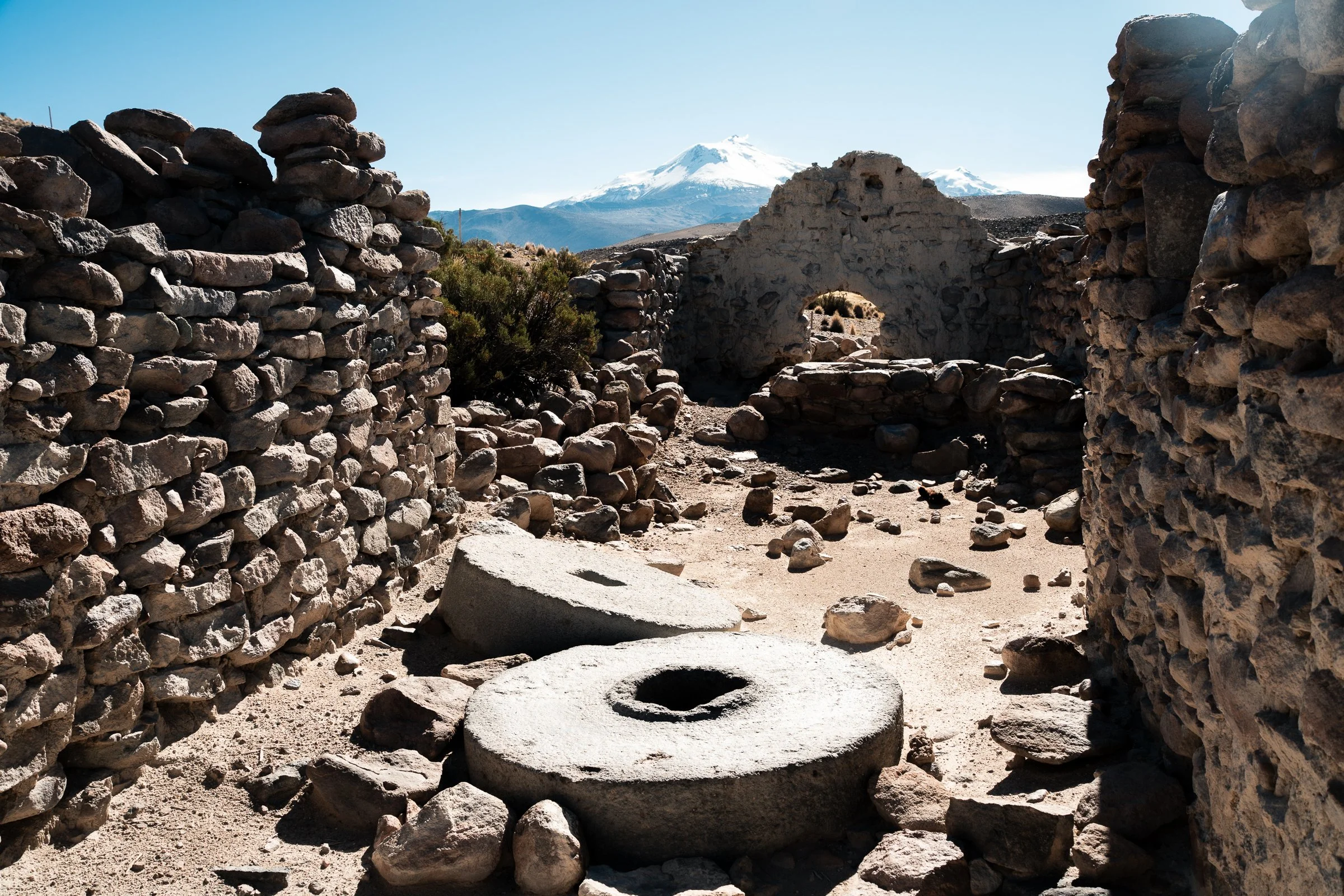
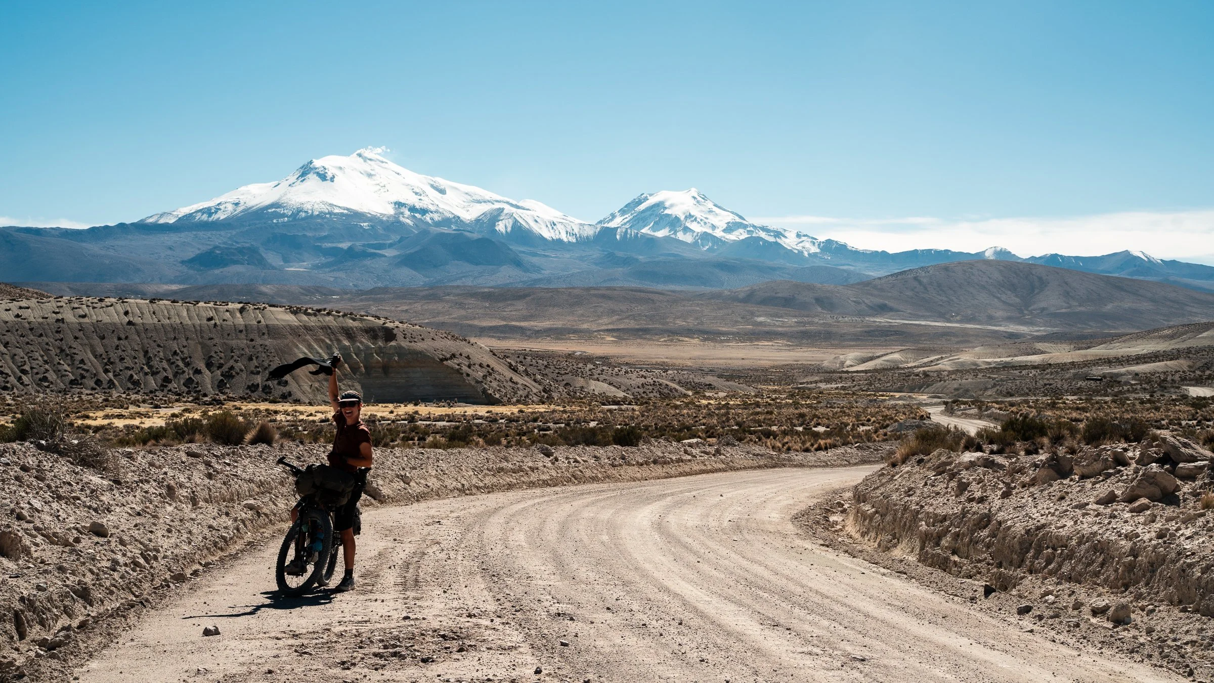
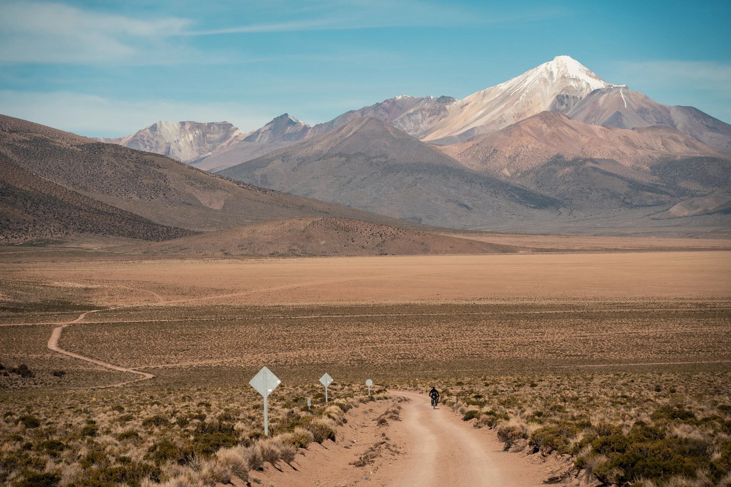
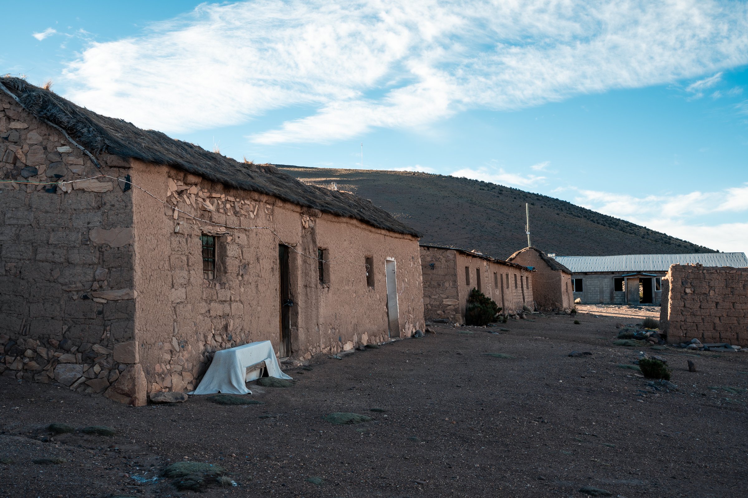
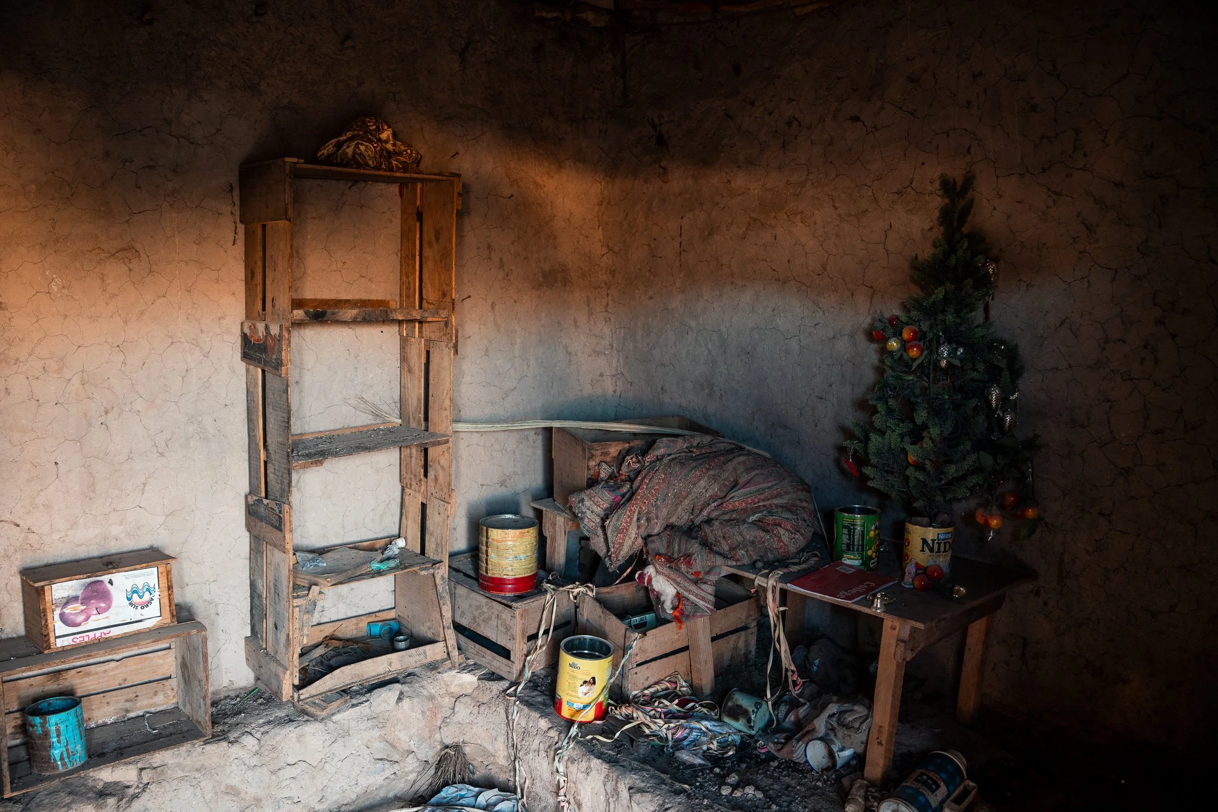
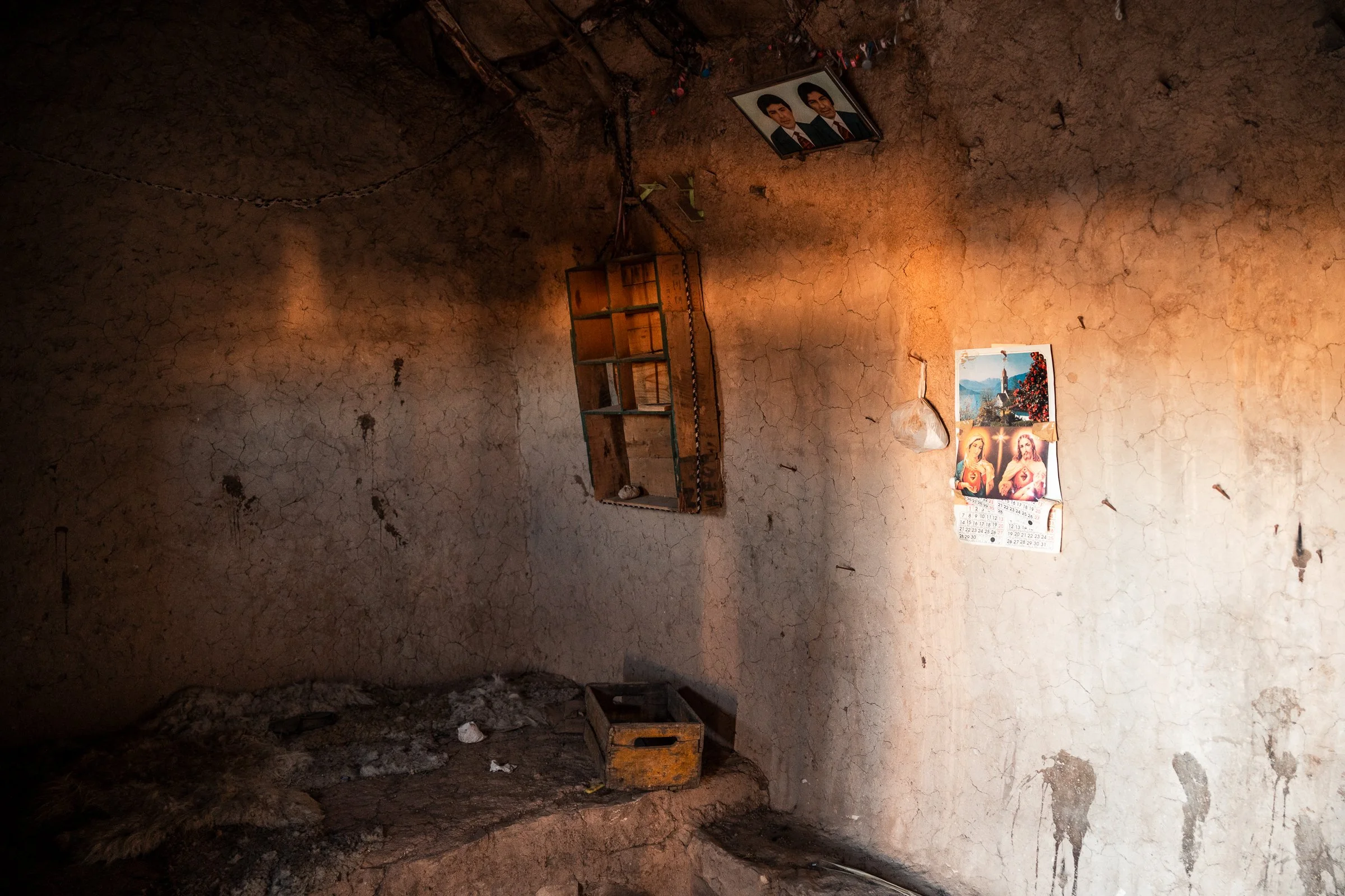
We climbed to the high-point of this route (4740m), a gradual gradient but an altitude that still took my breath away (Lauren faired much better). After struggling to the top, it was a different scene altogether, nearly devoid of plants over the pass, bare rock everywhere. The descent was long, smooth, sandy, and fast; just what we wanted. We then had to turn south and into a headwind down a plain, making the last 10km of the day a bitterly cold fight. We stopped in an abandoned village and put our tent up inside a clean looking room; clearly not the first, as the inside door was labelled ‘Casa Ciclista’. All through the village were broken beer and wine bottles. At one end was a large open-plan building, likely an event space. The rest of the village were mud-brick buildings, all single rooms, mostly thatched roofs. One had a calendar of the year 2000, two portraits of young men, and a Christmas tree. Others had the odd piece of furniture. It was a pleasant reprieve from the cold and wind, even if we were creeped out by the Christmas tree.
By this time we had barely seen a single other person (tourist or otherwise) the entire route. Setting off the next morning it wasn’t long before we saw our first tourists, as they pulled up in a ute to see if we were alright. Not long after that, a convoy of three passed us, and then an entire group of 15 at a mirador. No other cyclists or overlanders though.
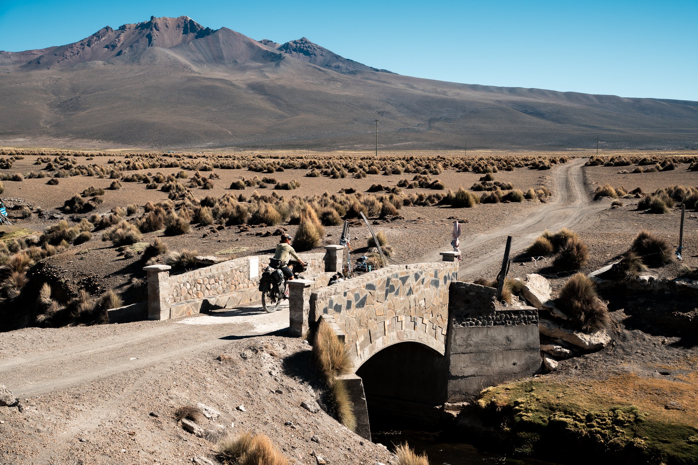
We passed another old church, beautifully painted. These old adobe Jesuit mission churches dot the landscape in this region in Chile and Bolivia, remnants of the 17th century path taken by colonists from the coast to the city of Potosi. Generally locked, they are all in much better condition than the often completely abandoned villages that surround them. Mostly downhill for the day, it wasn’t long before we were at the border with Bolivia again, but not before stopping for one quick Chilean meal. To our great enjoyment, it was actually served with sauce! Some flavour! Bolivian food on the other hand typically consists of meat (often deep fried), and rice or corn, with boiled potatoes; no sauce or flavourings added. We checked into a room in Pisigar Bolivar (the Bolivian border town, if you could call it that), and washed four days of dust off ourselves and our clothes.